You are here: Home > Network List > TA - USArray Transportable Network (new EarthScope stations) Stations List
> Station E20K Nigu River, AK, USA > Earthquake Result Viewer
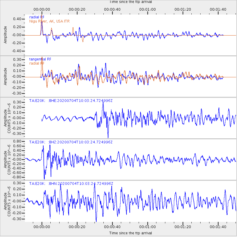
E20K Nigu River, AK, USA - Earthquake Result Viewer
*The percent match for this event was below the threshold and hence no stack was calculated.
| Earthquake location: |
Tajikistan |
| Earthquake latitude/longitude: |
39.1/70.9 |
| Earthquake time(UTC): |
2020/07/04 (186) 09:53:00 GMT |
| Earthquake Depth: |
10 km |
| Earthquake Magnitude: |
5.4 Mww |
| Earthquake Catalog/Contributor: |
NEIC PDE/us |
|
| Network: |
TA USArray Transportable Network (new EarthScope stations) |
| Station: |
E20K Nigu River, AK, USA |
| Lat/Lon: |
68.26 N/156.19 W |
| Elevation: |
866 m |
|
| Distance: |
67.4 deg |
| Az: |
17.199 deg |
| Baz: |
321.838 deg |
| Ray Param: |
$rayparam |
*The percent match for this event was below the threshold and hence was not used in the summary stack. |
|
| Radial Match: |
74.56895 % |
| Radial Bump: |
400 |
| Transverse Match: |
63.96045 % |
| Transverse Bump: |
400 |
| SOD ConfigId: |
21709731 |
| Insert Time: |
2020-07-18 10:08:00.288 +0000 |
| GWidth: |
2.5 |
| Max Bumps: |
400 |
| Tol: |
0.001 |
|
Signal To Noise
| Channel | StoN | STA | LTA |
| TA:E20K: :BHZ:20200704T10:03:24.724996Z | 7.7235713 | 4.1603792E-7 | 5.3866007E-8 |
| TA:E20K: :BHN:20200704T10:03:24.724996Z | 3.893327 | 1.0903183E-7 | 2.8004797E-8 |
| TA:E20K: :BHE:20200704T10:03:24.724996Z | 4.399694 | 1.2163872E-7 | 2.7647086E-8 |
| Arrivals |
| Ps | |
| PpPs | |
| PsPs/PpSs | |


