You are here: Home > Network List > TA - USArray Transportable Network (new EarthScope stations) Stations List
> Station M16K Timber Creek, AK, USA > Earthquake Result Viewer
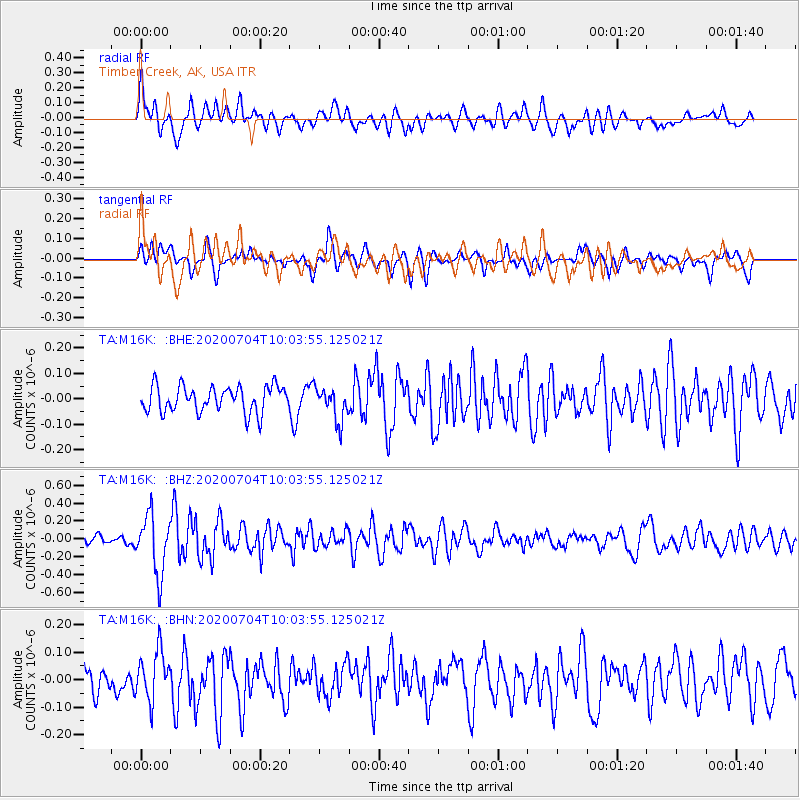
M16K Timber Creek, AK, USA - Earthquake Result Viewer
*The percent match for this event was below the threshold and hence no stack was calculated.
| Earthquake location: |
Tajikistan |
| Earthquake latitude/longitude: |
39.1/70.9 |
| Earthquake time(UTC): |
2020/07/04 (186) 09:53:00 GMT |
| Earthquake Depth: |
10 km |
| Earthquake Magnitude: |
5.4 Mww |
| Earthquake Catalog/Contributor: |
NEIC PDE/us |
|
| Network: |
TA USArray Transportable Network (new EarthScope stations) |
| Station: |
M16K Timber Creek, AK, USA |
| Lat/Lon: |
61.02 N/158.96 W |
| Elevation: |
394 m |
|
| Distance: |
72.3 deg |
| Az: |
23.002 deg |
| Baz: |
321.336 deg |
| Ray Param: |
$rayparam |
*The percent match for this event was below the threshold and hence was not used in the summary stack. |
|
| Radial Match: |
73.560135 % |
| Radial Bump: |
400 |
| Transverse Match: |
63.403206 % |
| Transverse Bump: |
400 |
| SOD ConfigId: |
21709731 |
| Insert Time: |
2020-07-18 10:09:25.460 +0000 |
| GWidth: |
2.5 |
| Max Bumps: |
400 |
| Tol: |
0.001 |
|
Signal To Noise
| Channel | StoN | STA | LTA |
| TA:M16K: :BHZ:20200704T10:03:55.125021Z | 5.914792 | 3.2646525E-7 | 5.5194715E-8 |
| TA:M16K: :BHN:20200704T10:03:55.125021Z | 1.9846214 | 8.861309E-8 | 4.464987E-8 |
| TA:M16K: :BHE:20200704T10:03:55.125021Z | 1.2814367 | 6.6075394E-8 | 5.1563525E-8 |
| Arrivals |
| Ps | |
| PpPs | |
| PsPs/PpSs | |


