You are here: Home > Network List > US - United States National Seismic Network Stations List
> Station EGMT Eagleton, Montana, USA > Earthquake Result Viewer
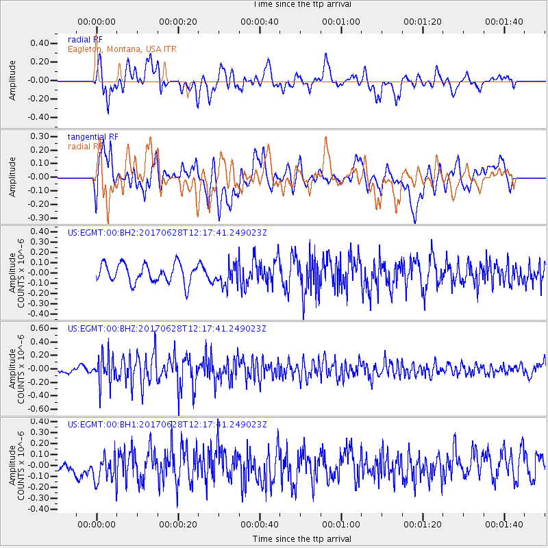
EGMT Eagleton, Montana, USA - Earthquake Result Viewer
*The percent match for this event was below the threshold and hence no stack was calculated.
| Earthquake location: |
Kuril Islands |
| Earthquake latitude/longitude: |
43.7/148.0 |
| Earthquake time(UTC): |
2017/06/28 (179) 12:07:30 GMT |
| Earthquake Depth: |
49 km |
| Earthquake Magnitude: |
5.4 Mww |
| Earthquake Catalog/Contributor: |
NEIC PDE/us |
|
| Network: |
US United States National Seismic Network |
| Station: |
EGMT Eagleton, Montana, USA |
| Lat/Lon: |
48.02 N/109.75 W |
| Elevation: |
1055 m |
|
| Distance: |
66.0 deg |
| Az: |
45.899 deg |
| Baz: |
309.134 deg |
| Ray Param: |
$rayparam |
*The percent match for this event was below the threshold and hence was not used in the summary stack. |
|
| Radial Match: |
66.134026 % |
| Radial Bump: |
400 |
| Transverse Match: |
53.511456 % |
| Transverse Bump: |
400 |
| SOD ConfigId: |
2140511 |
| Insert Time: |
2017-07-12 04:10:40.169 +0000 |
| GWidth: |
2.5 |
| Max Bumps: |
400 |
| Tol: |
0.001 |
|
Signal To Noise
| Channel | StoN | STA | LTA |
| US:EGMT:00:BHZ:20170628T12:17:41.249023Z | 3.341108 | 2.0434805E-7 | 6.1161764E-8 |
| US:EGMT:00:BH1:20170628T12:17:41.249023Z | 2.060455 | 1.3568318E-7 | 6.585108E-8 |
| US:EGMT:00:BH2:20170628T12:17:41.249023Z | 1.129646 | 1.0305859E-7 | 9.123088E-8 |
| Arrivals |
| Ps | |
| PpPs | |
| PsPs/PpSs | |


