WRPS We R Penn State - Earthquake Result Viewer
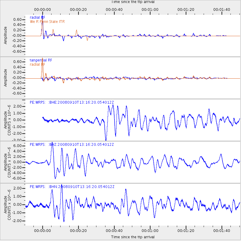
Earthquake location: Central Mid-Atlantic Ridge
Earthquake latitude/longitude: 8.1/-38.7
Earthquake time(UTC): 2008/09/10 (254) 13:08:14 GMT
Earthquake Depth: 10 km
Earthquake Magnitude: 6.3 MB, 6.5 MS, 6.6 MW, 6.6 MW
Earthquake Catalog/Contributor: WHDF/NEIC
Network: PE Penn State Network
Station: WRPS We R Penn State
Lat/Lon: 40.79 N/77.87 W
Elevation: 320 m
Distance: 47.6 deg
Az: 319.545 deg
Baz: 122.197 deg
Ray Param: 0.0698716
Estimated Moho Depth: 23.75 km
Estimated Crust Vp/Vs: 1.60
Assumed Crust Vp: 6.121 km/s
Estimated Crust Vs: 3.825 km/s
Estimated Crust Poisson's Ratio: 0.18
Radial Match: 93.44847 %
Radial Bump: 303
Transverse Match: 74.611755 %
Transverse Bump: 400
SOD ConfigId: 2560
Insert Time: 2010-02-26 14:56:34.865 +0000
GWidth: 2.5
Max Bumps: 400
Tol: 0.001

Signal To Noise

ChannelStoNSTALTA
PE:WRPS: :BHZ:20080910T13:16:20.054012Z4.13598638.9435366E-72.162371E-7
PE:WRPS: :BHN:20080910T13:16:20.054012Z2.1635723.1515268E-71.4566312E-7
PE:WRPS: :BHE:20080910T13:16:20.054012Z2.78123864.2533614E-71.5293047E-7
Arrivals
Ps2.5 SECOND
PpPs9.5 SECOND
PsPs/PpSs12 SECOND