You are here: Home > Network List > KN - Kyrgyz Seismic Telemetry Network Stations List
> Station USP KN.USP > Earthquake Result Viewer
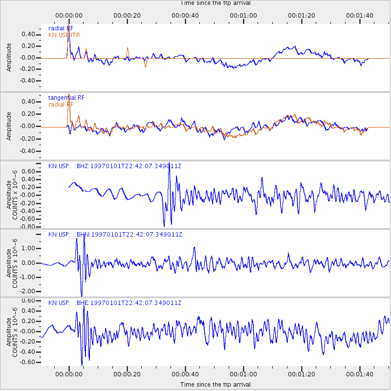
USP KN.USP - Earthquake Result Viewer
*The percent match for this event was below the threshold and hence no stack was calculated.
| Earthquake location: |
Minahassa Peninsula, Sulawesi |
| Earthquake latitude/longitude: |
-0.1/123.8 |
| Earthquake time(UTC): |
1997/01/01 (001) 22:32:32 GMT |
| Earthquake Depth: |
115 km |
| Earthquake Magnitude: |
5.9 MB, 5.8 UNKNOWN, 5.7 MW |
| Earthquake Catalog/Contributor: |
WHDF/NEIC |
|
| Network: |
KN Kyrgyz Seismic Telemetry Network |
| Station: |
USP KN.USP |
| Lat/Lon: |
43.27 N/74.50 E |
| Elevation: |
740 m |
|
| Distance: |
61.7 deg |
| Az: |
320.995 deg |
| Baz: |
120.501 deg |
| Ray Param: |
$rayparam |
*The percent match for this event was below the threshold and hence was not used in the summary stack. |
|
| Radial Match: |
55.46381 % |
| Radial Bump: |
400 |
| Transverse Match: |
44.659496 % |
| Transverse Bump: |
400 |
| SOD ConfigId: |
4480 |
| Insert Time: |
2010-03-08 22:31:00.105 +0000 |
| GWidth: |
2.5 |
| Max Bumps: |
400 |
| Tol: |
0.001 |
|
Signal To Noise
| Channel | StoN | STA | LTA |
| KN:USP: :BHN:19970101T22:42:07.349011Z | 13.753376 | 8.619363E-7 | 6.267089E-8 |
| KN:USP: :BHE:19970101T22:42:07.349011Z | 1.9819546 | 2.426326E-7 | 1.2242087E-7 |
| KN:USP: :BHZ:19970101T22:42:07.349011Z | 3.196307 | 3.599232E-7 | 1.1260596E-7 |
| Arrivals |
| Ps | |
| PpPs | |
| PsPs/PpSs | |


