You are here: Home > Network List > PE - Penn State Network Stations List
> Station WRPS We R Penn State > Earthquake Result Viewer
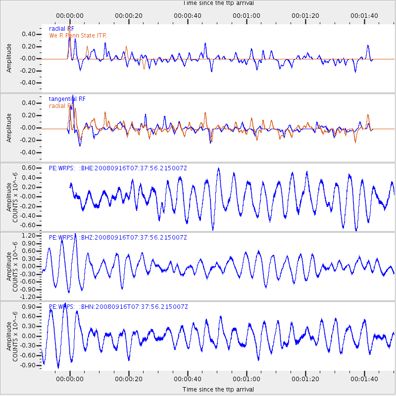
WRPS We R Penn State - Earthquake Result Viewer
*The percent match for this event was below the threshold and hence no stack was calculated.
| Earthquake location: |
Central Mid-Atlantic Ridge |
| Earthquake latitude/longitude: |
0.9/-29.0 |
| Earthquake time(UTC): |
2008/09/16 (260) 07:28:25 GMT |
| Earthquake Depth: |
10 km |
| Earthquake Magnitude: |
5.8 MW, 5.2 MS, 5.2 MB, 5.8 MW |
| Earthquake Catalog/Contributor: |
WHDF/NEIC |
|
| Network: |
PE Penn State Network |
| Station: |
WRPS We R Penn State |
| Lat/Lon: |
40.79 N/77.87 W |
| Elevation: |
320 m |
|
| Distance: |
59.4 deg |
| Az: |
318.349 deg |
| Baz: |
118.927 deg |
| Ray Param: |
$rayparam |
*The percent match for this event was below the threshold and hence was not used in the summary stack. |
|
| Radial Match: |
60.702667 % |
| Radial Bump: |
400 |
| Transverse Match: |
80.443504 % |
| Transverse Bump: |
400 |
| SOD ConfigId: |
2560 |
| Insert Time: |
2010-02-26 14:56:47.326 +0000 |
| GWidth: |
2.5 |
| Max Bumps: |
400 |
| Tol: |
0.001 |
|
Signal To Noise
| Channel | StoN | STA | LTA |
| PE:WRPS: :BHZ:20080916T07:37:56.215007Z | 2.5046432 | 7.5875323E-7 | 3.0293867E-7 |
| PE:WRPS: :BHN:20080916T07:37:56.215007Z | 1.3371791 | 5.0078427E-7 | 3.74508E-7 |
| PE:WRPS: :BHE:20080916T07:37:56.215007Z | 1.7534622 | 2.4501637E-7 | 1.397329E-7 |
| Arrivals |
| Ps | |
| PpPs | |
| PsPs/PpSs | |


