You are here: Home > Network List > CN - Canadian National Seismograph Network Stations List
> Station INK INUVIK, NT > Earthquake Result Viewer
INK INUVIK, NT - Earthquake Result Viewer
*The percent match for this event was below the threshold and hence no stack was calculated.
| Earthquake location: |
Solomon Islands |
| Earthquake latitude/longitude: |
-9.4/156.0 |
| Earthquake time(UTC): |
2020/06/20 (172) 15:45:10 GMT |
| Earthquake Depth: |
8.0 km |
| Earthquake Magnitude: |
5.4 Mww |
| Earthquake Catalog/Contributor: |
NEIC PDE/us |
|
| Network: |
CN Canadian National Seismograph Network |
| Station: |
INK INUVIK, NT |
| Lat/Lon: |
68.31 N/133.53 W |
| Elevation: |
44 m |
|
| Distance: |
91.6 deg |
| Az: |
20.518 deg |
| Baz: |
248.46 deg |
| Ray Param: |
$rayparam |
*The percent match for this event was below the threshold and hence was not used in the summary stack. |
|
| Radial Match: |
51.33359 % |
| Radial Bump: |
395 |
| Transverse Match: |
48.962593 % |
| Transverse Bump: |
400 |
| SOD ConfigId: |
21709731 |
| Insert Time: |
2020-07-19 14:55:14.594 +0000 |
| GWidth: |
2.5 |
| Max Bumps: |
400 |
| Tol: |
0.001 |
|
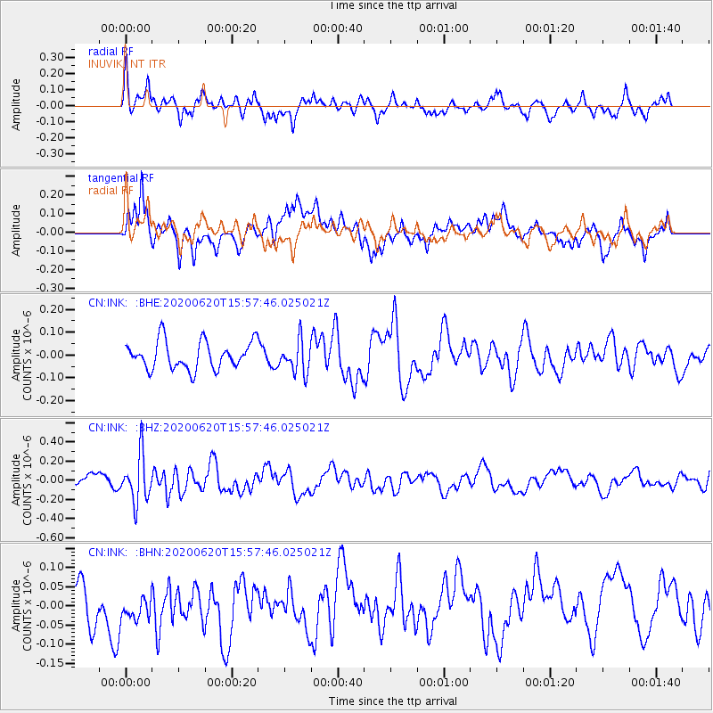
Signal To Noise
| Channel | StoN | STA | LTA |
| CN:INK: :BHZ:20200620T15:57:46.025021Z | 3.4270623 | 2.471144E-7 | 7.210677E-8 |
| CN:INK: :BHN:20200620T15:57:46.025021Z | 0.6391022 | 3.6496644E-8 | 5.710611E-8 |
| CN:INK: :BHE:20200620T15:57:46.025021Z | 1.1694281 | 7.114741E-8 | 6.083949E-8 |
| Arrivals |
| Ps | |
| PpPs | |
| PsPs/PpSs | |


