You are here: Home > Network List > IU - Global Seismograph Network (GSN - IRIS/USGS) Stations List
> Station PMG Port Moresby, New Guinea > Earthquake Result Viewer
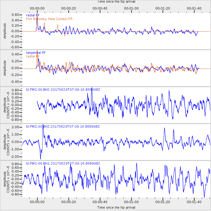
PMG Port Moresby, New Guinea - Earthquake Result Viewer
*The percent match for this event was below the threshold and hence no stack was calculated.
| Earthquake location: |
Kermadec Islands Region |
| Earthquake latitude/longitude: |
-31.1/180.0 |
| Earthquake time(UTC): |
2017/06/29 (180) 07:03:10 GMT |
| Earthquake Depth: |
392 km |
| Earthquake Magnitude: |
6.0 Mww |
| Earthquake Catalog/Contributor: |
NEIC PDE/us |
|
| Network: |
IU Global Seismograph Network (GSN - IRIS/USGS) |
| Station: |
PMG Port Moresby, New Guinea |
| Lat/Lon: |
9.40 S/147.16 E |
| Elevation: |
90 m |
|
| Distance: |
37.3 deg |
| Az: |
298.248 deg |
| Baz: |
130.022 deg |
| Ray Param: |
$rayparam |
*The percent match for this event was below the threshold and hence was not used in the summary stack. |
|
| Radial Match: |
59.92361 % |
| Radial Bump: |
400 |
| Transverse Match: |
53.72499 % |
| Transverse Bump: |
400 |
| SOD ConfigId: |
2140511 |
| Insert Time: |
2017-07-12 22:57:23.478 +0000 |
| GWidth: |
2.5 |
| Max Bumps: |
400 |
| Tol: |
0.001 |
|
Signal To Noise
| Channel | StoN | STA | LTA |
| IU:PMG:00:BHZ:20170629T07:09:16.868998Z | 5.806809 | 1.0489748E-6 | 1.8064567E-7 |
| IU:PMG:00:BH1:20170629T07:09:16.868998Z | 2.031352 | 3.5936586E-7 | 1.769097E-7 |
| IU:PMG:00:BH2:20170629T07:09:16.868998Z | 2.2831922 | 3.4084732E-7 | 1.4928543E-7 |
| Arrivals |
| Ps | |
| PpPs | |
| PsPs/PpSs | |


