You are here: Home > Network List > AV - Alaska Volcano Observatory Stations List
> Station MAPS Pakushin Southeast, Makushin Volcano, Alaska > Earthquake Result Viewer
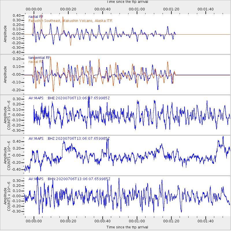
MAPS Pakushin Southeast, Makushin Volcano, Alaska - Earthquake Result Viewer
*The percent match for this event was below the threshold and hence no stack was calculated.
| Earthquake location: |
Mariana Islands Region |
| Earthquake latitude/longitude: |
21.0/144.8 |
| Earthquake time(UTC): |
2020/07/06 (188) 12:58:04 GMT |
| Earthquake Depth: |
124 km |
| Earthquake Magnitude: |
5.5 Mww |
| Earthquake Catalog/Contributor: |
NEIC PDE/us |
|
| Network: |
AV Alaska Volcano Observatory |
| Station: |
MAPS Pakushin Southeast, Makushin Volcano, Alaska |
| Lat/Lon: |
53.81 N/166.94 W |
| Elevation: |
333 m |
|
| Distance: |
49.0 deg |
| Az: |
35.893 deg |
| Baz: |
247.429 deg |
| Ray Param: |
$rayparam |
*The percent match for this event was below the threshold and hence was not used in the summary stack. |
|
| Radial Match: |
55.20403 % |
| Radial Bump: |
400 |
| Transverse Match: |
48.159466 % |
| Transverse Bump: |
400 |
| SOD ConfigId: |
21709731 |
| Insert Time: |
2020-07-20 13:02:58.699 +0000 |
| GWidth: |
2.5 |
| Max Bumps: |
400 |
| Tol: |
0.001 |
|
Signal To Noise
| Channel | StoN | STA | LTA |
| AV:MAPS: :BHZ:20200706T13:06:07.659985Z | 0.71353 | 2.775272E-7 | 3.8894956E-7 |
| AV:MAPS: :BHN:20200706T13:06:07.659985Z | 1.6201512 | 1.5445576E-7 | 9.5334165E-8 |
| AV:MAPS: :BHE:20200706T13:06:07.659985Z | 1.4154922 | 1.4263588E-7 | 1.0076769E-7 |
| Arrivals |
| Ps | |
| PpPs | |
| PsPs/PpSs | |


