You are here: Home > Network List > TA - USArray Transportable Network (new EarthScope stations) Stations List
> Station C16K Lisburne Hills, AK, USA > Earthquake Result Viewer
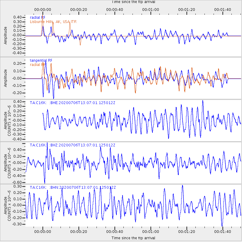
C16K Lisburne Hills, AK, USA - Earthquake Result Viewer
*The percent match for this event was below the threshold and hence no stack was calculated.
| Earthquake location: |
Mariana Islands Region |
| Earthquake latitude/longitude: |
21.0/144.8 |
| Earthquake time(UTC): |
2020/07/06 (188) 12:58:04 GMT |
| Earthquake Depth: |
124 km |
| Earthquake Magnitude: |
5.5 Mww |
| Earthquake Catalog/Contributor: |
NEIC PDE/us |
|
| Network: |
TA USArray Transportable Network (new EarthScope stations) |
| Station: |
C16K Lisburne Hills, AK, USA |
| Lat/Lon: |
68.27 N/165.34 W |
| Elevation: |
102 m |
|
| Distance: |
56.2 deg |
| Az: |
20.004 deg |
| Baz: |
239.126 deg |
| Ray Param: |
$rayparam |
*The percent match for this event was below the threshold and hence was not used in the summary stack. |
|
| Radial Match: |
48.386574 % |
| Radial Bump: |
377 |
| Transverse Match: |
61.265545 % |
| Transverse Bump: |
385 |
| SOD ConfigId: |
21709731 |
| Insert Time: |
2020-07-20 13:12:52.975 +0000 |
| GWidth: |
2.5 |
| Max Bumps: |
400 |
| Tol: |
0.001 |
|
Signal To Noise
| Channel | StoN | STA | LTA |
| TA:C16K: :BHZ:20200706T13:07:01.125012Z | 2.5386407 | 2.8422605E-7 | 1.11959935E-7 |
| TA:C16K: :BHN:20200706T13:07:01.125012Z | 0.877624 | 1.02730084E-7 | 1.1705479E-7 |
| TA:C16K: :BHE:20200706T13:07:01.125012Z | 1.1949874 | 1.0331894E-7 | 8.646027E-8 |
| Arrivals |
| Ps | |
| PpPs | |
| PsPs/PpSs | |


