You are here: Home > Network List > TA - USArray Transportable Network (new EarthScope stations) Stations List
> Station F20K Avaraart Lake, AK, USA > Earthquake Result Viewer
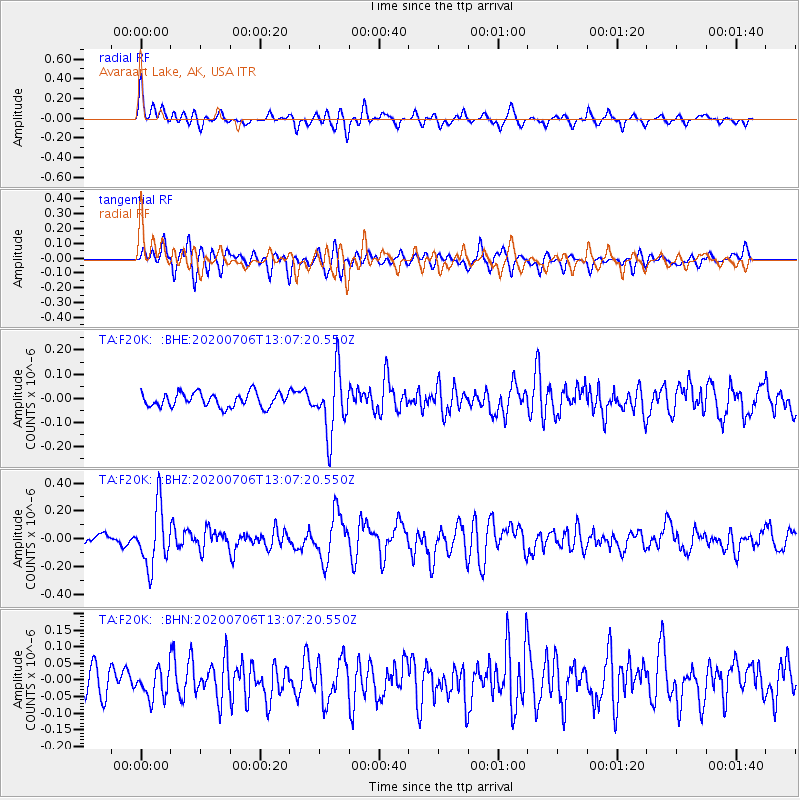
F20K Avaraart Lake, AK, USA - Earthquake Result Viewer
*The percent match for this event was below the threshold and hence no stack was calculated.
| Earthquake location: |
Mariana Islands Region |
| Earthquake latitude/longitude: |
21.0/144.8 |
| Earthquake time(UTC): |
2020/07/06 (188) 12:58:04 GMT |
| Earthquake Depth: |
124 km |
| Earthquake Magnitude: |
5.5 Mww |
| Earthquake Catalog/Contributor: |
NEIC PDE/us |
|
| Network: |
TA USArray Transportable Network (new EarthScope stations) |
| Station: |
F20K Avaraart Lake, AK, USA |
| Lat/Lon: |
67.05 N/155.73 W |
| Elevation: |
136 m |
|
| Distance: |
59.0 deg |
| Az: |
23.193 deg |
| Baz: |
249.726 deg |
| Ray Param: |
$rayparam |
*The percent match for this event was below the threshold and hence was not used in the summary stack. |
|
| Radial Match: |
62.91997 % |
| Radial Bump: |
400 |
| Transverse Match: |
64.33955 % |
| Transverse Bump: |
400 |
| SOD ConfigId: |
21709731 |
| Insert Time: |
2020-07-20 13:13:38.406 +0000 |
| GWidth: |
2.5 |
| Max Bumps: |
400 |
| Tol: |
0.001 |
|
Signal To Noise
| Channel | StoN | STA | LTA |
| TA:F20K: :BHZ:20200706T13:07:20.550Z | 3.676454 | 2.1063653E-7 | 5.7293395E-8 |
| TA:F20K: :BHN:20200706T13:07:20.550Z | 0.91075325 | 4.34902E-8 | 4.77519E-8 |
| TA:F20K: :BHE:20200706T13:07:20.550Z | 4.389458 | 1.2755314E-7 | 2.905897E-8 |
| Arrivals |
| Ps | |
| PpPs | |
| PsPs/PpSs | |


