You are here: Home > Network List > TA - USArray Transportable Network (new EarthScope stations) Stations List
> Station H16K Elim, AK, USA > Earthquake Result Viewer
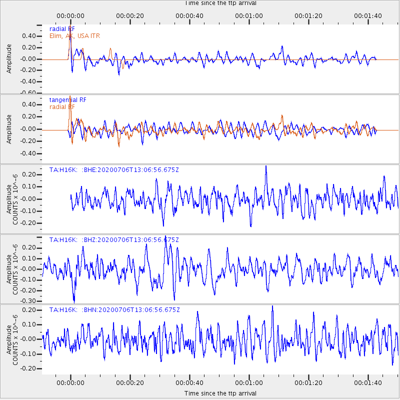
H16K Elim, AK, USA - Earthquake Result Viewer
*The percent match for this event was below the threshold and hence no stack was calculated.
| Earthquake location: |
Mariana Islands Region |
| Earthquake latitude/longitude: |
21.0/144.8 |
| Earthquake time(UTC): |
2020/07/06 (188) 12:58:04 GMT |
| Earthquake Depth: |
124 km |
| Earthquake Magnitude: |
5.5 Mww |
| Earthquake Catalog/Contributor: |
NEIC PDE/us |
|
| Network: |
TA USArray Transportable Network (new EarthScope stations) |
| Station: |
H16K Elim, AK, USA |
| Lat/Lon: |
64.64 N/162.24 W |
| Elevation: |
216 m |
|
| Distance: |
55.6 deg |
| Az: |
24.602 deg |
| Baz: |
244.548 deg |
| Ray Param: |
$rayparam |
*The percent match for this event was below the threshold and hence was not used in the summary stack. |
|
| Radial Match: |
56.187717 % |
| Radial Bump: |
400 |
| Transverse Match: |
59.256775 % |
| Transverse Bump: |
400 |
| SOD ConfigId: |
21709731 |
| Insert Time: |
2020-07-20 13:14:09.806 +0000 |
| GWidth: |
2.5 |
| Max Bumps: |
400 |
| Tol: |
0.001 |
|
Signal To Noise
| Channel | StoN | STA | LTA |
| TA:H16K: :BHZ:20200706T13:06:56.675Z | 2.1733851 | 1.2835082E-7 | 5.905572E-8 |
| TA:H16K: :BHN:20200706T13:06:56.675Z | 0.88299257 | 5.508443E-8 | 6.23838E-8 |
| TA:H16K: :BHE:20200706T13:06:56.675Z | 1.9314166 | 1.02365775E-7 | 5.300036E-8 |
| Arrivals |
| Ps | |
| PpPs | |
| PsPs/PpSs | |


