You are here: Home > Network List > TA - USArray Transportable Network (new EarthScope stations) Stations List
> Station L15K Ungalak Mountain, AK, USA > Earthquake Result Viewer
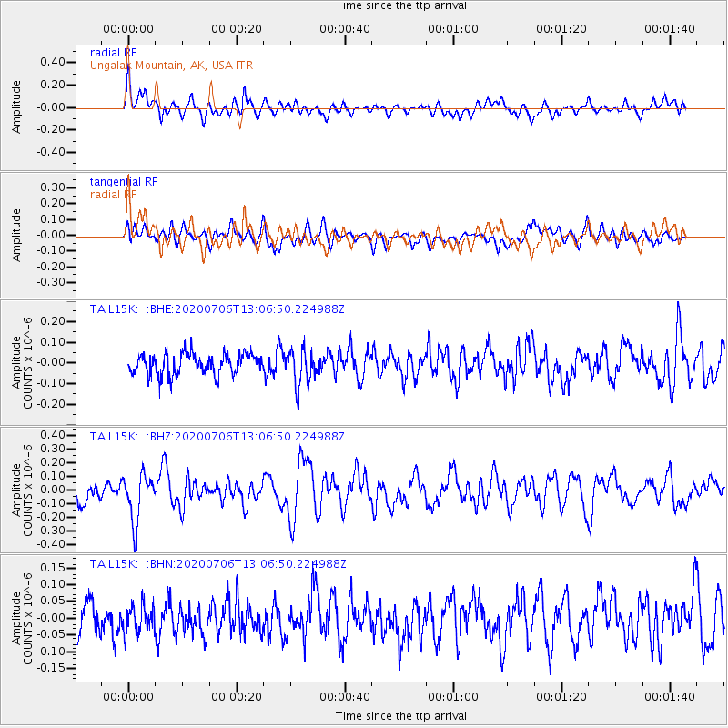
L15K Ungalak Mountain, AK, USA - Earthquake Result Viewer
*The percent match for this event was below the threshold and hence no stack was calculated.
| Earthquake location: |
Mariana Islands Region |
| Earthquake latitude/longitude: |
21.0/144.8 |
| Earthquake time(UTC): |
2020/07/06 (188) 12:58:04 GMT |
| Earthquake Depth: |
124 km |
| Earthquake Magnitude: |
5.5 Mww |
| Earthquake Catalog/Contributor: |
NEIC PDE/us |
|
| Network: |
TA USArray Transportable Network (new EarthScope stations) |
| Station: |
L15K Ungalak Mountain, AK, USA |
| Lat/Lon: |
61.68 N/161.49 W |
| Elevation: |
219 m |
|
| Distance: |
54.7 deg |
| Az: |
28.077 deg |
| Baz: |
247.204 deg |
| Ray Param: |
$rayparam |
*The percent match for this event was below the threshold and hence was not used in the summary stack. |
|
| Radial Match: |
69.70281 % |
| Radial Bump: |
400 |
| Transverse Match: |
53.808308 % |
| Transverse Bump: |
400 |
| SOD ConfigId: |
21709731 |
| Insert Time: |
2020-07-20 13:14:32.987 +0000 |
| GWidth: |
2.5 |
| Max Bumps: |
400 |
| Tol: |
0.001 |
|
Signal To Noise
| Channel | StoN | STA | LTA |
| TA:L15K: :BHZ:20200706T13:06:50.224988Z | 2.6837409 | 1.8123819E-7 | 6.753193E-8 |
| TA:L15K: :BHN:20200706T13:06:50.224988Z | 0.79887027 | 4.1404476E-8 | 5.1828785E-8 |
| TA:L15K: :BHE:20200706T13:06:50.224988Z | 1.7170556 | 8.627221E-8 | 5.0244275E-8 |
| Arrivals |
| Ps | |
| PpPs | |
| PsPs/PpSs | |


