You are here: Home > Network List > TA - USArray Transportable Network (new EarthScope stations) Stations List
> Station M31M Drury Creek, Yukon, CA > Earthquake Result Viewer
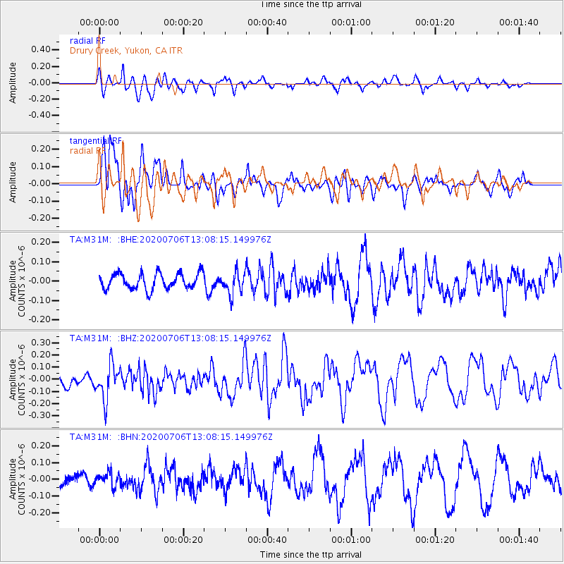
M31M Drury Creek, Yukon, CA - Earthquake Result Viewer
*The percent match for this event was below the threshold and hence no stack was calculated.
| Earthquake location: |
Mariana Islands Region |
| Earthquake latitude/longitude: |
21.0/144.8 |
| Earthquake time(UTC): |
2020/07/06 (188) 12:58:04 GMT |
| Earthquake Depth: |
124 km |
| Earthquake Magnitude: |
5.5 Mww |
| Earthquake Catalog/Contributor: |
NEIC PDE/us |
|
| Network: |
TA USArray Transportable Network (new EarthScope stations) |
| Station: |
M31M Drury Creek, Yukon, CA |
| Lat/Lon: |
62.20 N/134.39 W |
| Elevation: |
639 m |
|
| Distance: |
67.3 deg |
| Az: |
30.1 deg |
| Baz: |
272.165 deg |
| Ray Param: |
$rayparam |
*The percent match for this event was below the threshold and hence was not used in the summary stack. |
|
| Radial Match: |
61.12816 % |
| Radial Bump: |
400 |
| Transverse Match: |
78.86315 % |
| Transverse Bump: |
382 |
| SOD ConfigId: |
21709731 |
| Insert Time: |
2020-07-20 13:14:50.188 +0000 |
| GWidth: |
2.5 |
| Max Bumps: |
400 |
| Tol: |
0.001 |
|
Signal To Noise
| Channel | StoN | STA | LTA |
| TA:M31M: :BHZ:20200706T13:08:15.149976Z | 2.3912785 | 1.4590069E-7 | 6.101367E-8 |
| TA:M31M: :BHN:20200706T13:08:15.149976Z | 1.404991 | 4.2845834E-8 | 3.049545E-8 |
| TA:M31M: :BHE:20200706T13:08:15.149976Z | 1.4651713 | 5.975901E-8 | 4.078636E-8 |
| Arrivals |
| Ps | |
| PpPs | |
| PsPs/PpSs | |


