You are here: Home > Network List > US - United States National Seismic Network Stations List
> Station WMOK Wichita Mountains, Oklahoma, USA > Earthquake Result Viewer
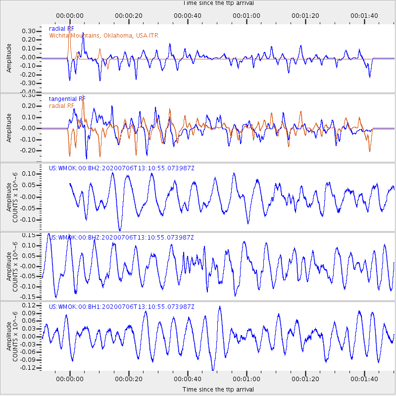
WMOK Wichita Mountains, Oklahoma, USA - Earthquake Result Viewer
*The percent match for this event was below the threshold and hence no stack was calculated.
| Earthquake location: |
Mariana Islands Region |
| Earthquake latitude/longitude: |
21.0/144.8 |
| Earthquake time(UTC): |
2020/07/06 (188) 12:58:04 GMT |
| Earthquake Depth: |
124 km |
| Earthquake Magnitude: |
5.5 Mww |
| Earthquake Catalog/Contributor: |
NEIC PDE/us |
|
| Network: |
US United States National Seismic Network |
| Station: |
WMOK Wichita Mountains, Oklahoma, USA |
| Lat/Lon: |
34.74 N/98.78 W |
| Elevation: |
486 m |
|
| Distance: |
98.0 deg |
| Az: |
48.169 deg |
| Baz: |
302.312 deg |
| Ray Param: |
$rayparam |
*The percent match for this event was below the threshold and hence was not used in the summary stack. |
|
| Radial Match: |
59.481483 % |
| Radial Bump: |
400 |
| Transverse Match: |
61.603203 % |
| Transverse Bump: |
400 |
| SOD ConfigId: |
21709731 |
| Insert Time: |
2020-07-20 13:16:44.470 +0000 |
| GWidth: |
2.5 |
| Max Bumps: |
400 |
| Tol: |
0.001 |
|
Signal To Noise
| Channel | StoN | STA | LTA |
| US:WMOK:00:BHZ:20200706T13:10:55.073987Z | 1.5022606 | 8.8390316E-8 | 5.8838204E-8 |
| US:WMOK:00:BH1:20200706T13:10:55.073987Z | 0.8674211 | 4.4713786E-8 | 5.1547957E-8 |
| US:WMOK:00:BH2:20200706T13:10:55.073987Z | 0.69591206 | 4.0949462E-8 | 5.8842872E-8 |
| Arrivals |
| Ps | |
| PpPs | |
| PsPs/PpSs | |


