You are here: Home > Network List > IW - Intermountain West Stations List
> Station PLID Pearl Lake, Idaho, USA > Earthquake Result Viewer
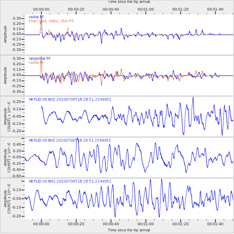
PLID Pearl Lake, Idaho, USA - Earthquake Result Viewer
*The percent match for this event was below the threshold and hence no stack was calculated.
| Earthquake location: |
W. Caroline Islands, Micronesia |
| Earthquake latitude/longitude: |
12.1/140.2 |
| Earthquake time(UTC): |
2020/07/06 (188) 18:16:18 GMT |
| Earthquake Depth: |
12 km |
| Earthquake Magnitude: |
6.2 mww |
| Earthquake Catalog/Contributor: |
NEIC PDE/us |
|
| Network: |
IW Intermountain West |
| Station: |
PLID Pearl Lake, Idaho, USA |
| Lat/Lon: |
45.09 N/116.00 W |
| Elevation: |
2164 m |
|
| Distance: |
91.0 deg |
| Az: |
43.488 deg |
| Baz: |
288.131 deg |
| Ray Param: |
$rayparam |
*The percent match for this event was below the threshold and hence was not used in the summary stack. |
|
| Radial Match: |
72.833824 % |
| Radial Bump: |
400 |
| Transverse Match: |
74.83034 % |
| Transverse Bump: |
400 |
| SOD ConfigId: |
21709731 |
| Insert Time: |
2020-07-20 18:27:51.918 +0000 |
| GWidth: |
2.5 |
| Max Bumps: |
400 |
| Tol: |
0.001 |
|
Signal To Noise
| Channel | StoN | STA | LTA |
| IW:PLID:00:BHZ:20200706T18:28:51.224995Z | 2.2363477 | 1.3748686E-7 | 6.147831E-8 |
| IW:PLID:00:BH1:20200706T18:28:51.224995Z | 0.7201819 | 3.8413184E-8 | 5.3338166E-8 |
| IW:PLID:00:BH2:20200706T18:28:51.224995Z | 0.401897 | 2.1367125E-8 | 5.316567E-8 |
| Arrivals |
| Ps | |
| PpPs | |
| PsPs/PpSs | |


