You are here: Home > Network List > TA - USArray Transportable Network (new EarthScope stations) Stations List
> Station H16K Elim, AK, USA > Earthquake Result Viewer
H16K Elim, AK, USA - Earthquake Result Viewer

| Earthquake location: |
W. Caroline Islands, Micronesia |
| Earthquake latitude/longitude: |
12.1/140.2 |
| Earthquake time(UTC): |
2020/07/06 (188) 18:16:18 GMT |
| Earthquake Depth: |
12 km |
| Earthquake Magnitude: |
6.2 mww |
| Earthquake Catalog/Contributor: |
NEIC PDE/us |
|
| Network: |
TA USArray Transportable Network (new EarthScope stations) |
| Station: |
H16K Elim, AK, USA |
| Lat/Lon: |
64.64 N/162.24 W |
| Elevation: |
216 m |
|
| Distance: |
65.6 deg |
| Az: |
23.517 deg |
| Baz: |
245.0 deg |
| Ray Param: |
0.058173973 |
| Estimated Moho Depth: |
68.75 km |
| Estimated Crust Vp/Vs: |
2.05 |
| Assumed Crust Vp: |
6.276 km/s |
| Estimated Crust Vs: |
3.069 km/s |
| Estimated Crust Poisson's Ratio: |
0.34 |
|
| Radial Match: |
89.6335 % |
| Radial Bump: |
400 |
| Transverse Match: |
75.017815 % |
| Transverse Bump: |
400 |
| SOD ConfigId: |
21709731 |
| Insert Time: |
2020-07-20 18:32:04.639 +0000 |
| GWidth: |
2.5 |
| Max Bumps: |
400 |
| Tol: |
0.001 |
|
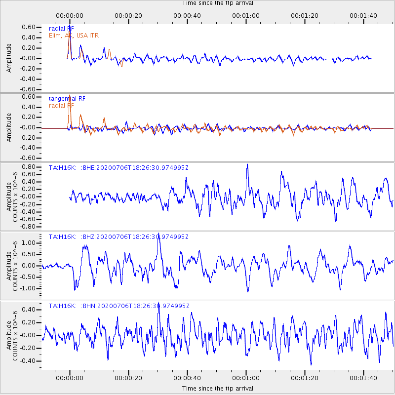
Signal To Noise
| Channel | StoN | STA | LTA |
| TA:H16K: :BHZ:20200706T18:26:30.974995Z | 7.8858914 | 5.4349726E-7 | 6.892021E-8 |
| TA:H16K: :BHN:20200706T18:26:30.974995Z | 2.0032487 | 1.12184516E-7 | 5.600129E-8 |
| TA:H16K: :BHE:20200706T18:26:30.974995Z | 2.2804046 | 1.8268743E-7 | 8.0111846E-8 |
| Arrivals |
| Ps | 12 SECOND |
| PpPs | 32 SECOND |
| PsPs/PpSs | 44 SECOND |


