You are here: Home > Network List > UU - University of Utah Regional Network Stations List
> Station CCUT Cedar City, UT, USA > Earthquake Result Viewer
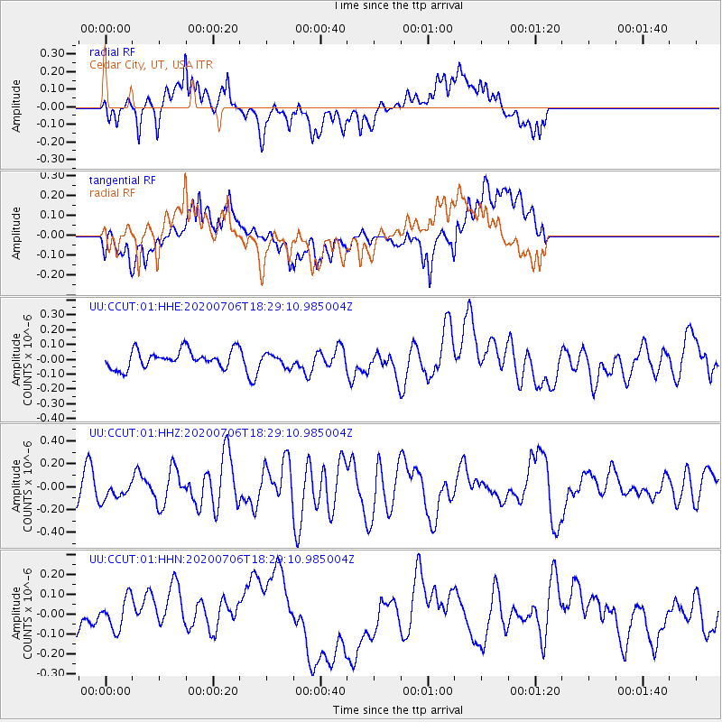
CCUT Cedar City, UT, USA - Earthquake Result Viewer
*The percent match for this event was below the threshold and hence no stack was calculated.
| Earthquake location: |
W. Caroline Islands, Micronesia |
| Earthquake latitude/longitude: |
12.1/140.2 |
| Earthquake time(UTC): |
2020/07/06 (188) 18:16:18 GMT |
| Earthquake Depth: |
12 km |
| Earthquake Magnitude: |
6.2 mww |
| Earthquake Catalog/Contributor: |
NEIC PDE/us |
|
| Network: |
UU University of Utah Regional Network |
| Station: |
CCUT Cedar City, UT, USA |
| Lat/Lon: |
37.55 N/113.36 W |
| Elevation: |
2127 m |
|
| Distance: |
95.4 deg |
| Az: |
49.981 deg |
| Baz: |
289.506 deg |
| Ray Param: |
$rayparam |
*The percent match for this event was below the threshold and hence was not used in the summary stack. |
|
| Radial Match: |
62.03432 % |
| Radial Bump: |
400 |
| Transverse Match: |
44.96772 % |
| Transverse Bump: |
400 |
| SOD ConfigId: |
21709731 |
| Insert Time: |
2020-07-20 18:34:42.208 +0000 |
| GWidth: |
2.5 |
| Max Bumps: |
400 |
| Tol: |
0.001 |
|
Signal To Noise
| Channel | StoN | STA | LTA |
| UU:CCUT:01:HHZ:20200706T18:29:10.985004Z | 0.7766996 | 8.471456E-8 | 1.0906991E-7 |
| UU:CCUT:01:HHN:20200706T18:29:10.985004Z | 0.634053 | 7.998595E-8 | 1.2615027E-7 |
| UU:CCUT:01:HHE:20200706T18:29:10.985004Z | 0.69079447 | 4.1095067E-8 | 5.9489572E-8 |
| Arrivals |
| Ps | |
| PpPs | |
| PsPs/PpSs | |


