You are here: Home > Network List > WY - Yellowstone Wyoming Seismic Network Stations List
> Station YHH Holmes Hill, YNP, WY, USA > Earthquake Result Viewer
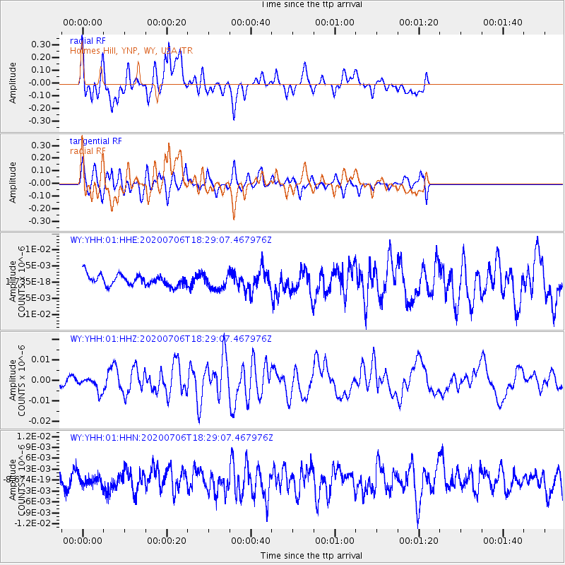
YHH Holmes Hill, YNP, WY, USA - Earthquake Result Viewer
*The percent match for this event was below the threshold and hence no stack was calculated.
| Earthquake location: |
W. Caroline Islands, Micronesia |
| Earthquake latitude/longitude: |
12.1/140.2 |
| Earthquake time(UTC): |
2020/07/06 (188) 18:16:18 GMT |
| Earthquake Depth: |
12 km |
| Earthquake Magnitude: |
6.2 mww |
| Earthquake Catalog/Contributor: |
NEIC PDE/us |
|
| Network: |
WY Yellowstone Wyoming Seismic Network |
| Station: |
YHH Holmes Hill, YNP, WY, USA |
| Lat/Lon: |
44.79 N/110.85 W |
| Elevation: |
2717 m |
|
| Distance: |
94.6 deg |
| Az: |
42.519 deg |
| Baz: |
291.806 deg |
| Ray Param: |
$rayparam |
*The percent match for this event was below the threshold and hence was not used in the summary stack. |
|
| Radial Match: |
76.628 % |
| Radial Bump: |
400 |
| Transverse Match: |
74.772156 % |
| Transverse Bump: |
400 |
| SOD ConfigId: |
21709731 |
| Insert Time: |
2020-07-20 18:35:59.603 +0000 |
| GWidth: |
2.5 |
| Max Bumps: |
400 |
| Tol: |
0.001 |
|
Signal To Noise
| Channel | StoN | STA | LTA |
| WY:YHH:01:HHZ:20200706T18:29:07.467976Z | 2.7864451 | 3.6151249E-9 | 1.2973967E-9 |
| WY:YHH:01:HHN:20200706T18:29:07.467976Z | 0.6052013 | 1.2988827E-9 | 2.1461994E-9 |
| WY:YHH:01:HHE:20200706T18:29:07.467976Z | 1.3888224 | 2.3078894E-9 | 1.6617598E-9 |
| Arrivals |
| Ps | |
| PpPs | |
| PsPs/PpSs | |


