You are here: Home > Network List > UU - University of Utah Regional Network Stations List
> Station CCUT Cedar City, UT, USA > Earthquake Result Viewer
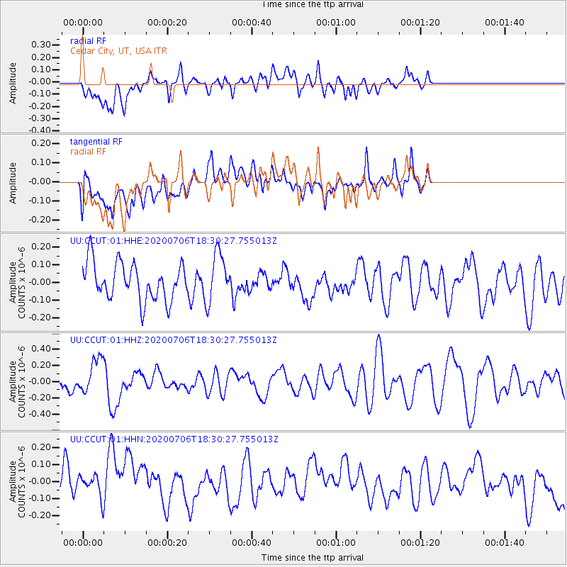
CCUT Cedar City, UT, USA - Earthquake Result Viewer
*The percent match for this event was below the threshold and hence no stack was calculated.
| Earthquake location: |
Southeast Of Honshu, Japan |
| Earthquake latitude/longitude: |
31.5/138.2 |
| Earthquake time(UTC): |
2020/07/06 (188) 18:19:09 GMT |
| Earthquake Depth: |
381 km |
| Earthquake Magnitude: |
5.6 Mww |
| Earthquake Catalog/Contributor: |
NEIC PDE/us |
|
| Network: |
UU University of Utah Regional Network |
| Station: |
CCUT Cedar City, UT, USA |
| Lat/Lon: |
37.55 N/113.36 W |
| Elevation: |
2127 m |
|
| Distance: |
84.3 deg |
| Az: |
49.251 deg |
| Baz: |
305.471 deg |
| Ray Param: |
$rayparam |
*The percent match for this event was below the threshold and hence was not used in the summary stack. |
|
| Radial Match: |
55.713886 % |
| Radial Bump: |
400 |
| Transverse Match: |
44.519676 % |
| Transverse Bump: |
400 |
| SOD ConfigId: |
21709731 |
| Insert Time: |
2020-07-20 18:57:09.000 +0000 |
| GWidth: |
2.5 |
| Max Bumps: |
400 |
| Tol: |
0.001 |
|
Signal To Noise
| Channel | StoN | STA | LTA |
| UU:CCUT:01:HHZ:20200706T18:30:27.755013Z | 1.179905 | 2.2547677E-7 | 1.9109739E-7 |
| UU:CCUT:01:HHN:20200706T18:30:27.755013Z | 0.6960727 | 1.0318179E-7 | 1.4823421E-7 |
| UU:CCUT:01:HHE:20200706T18:30:27.755013Z | 1.3477318 | 1.412646E-7 | 1.0481655E-7 |
| Arrivals |
| Ps | |
| PpPs | |
| PsPs/PpSs | |


