You are here: Home > Network List > UU - University of Utah Regional Network Stations List
> Station FORU South Mineral Mountains, UT, USA > Earthquake Result Viewer
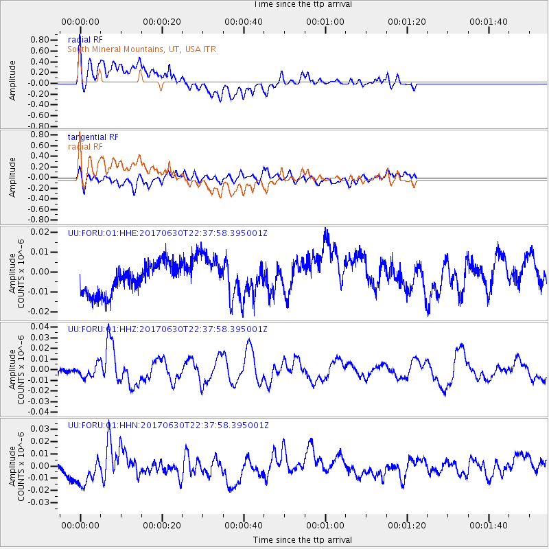
FORU South Mineral Mountains, UT, USA - Earthquake Result Viewer
*The percent match for this event was below the threshold and hence no stack was calculated.
| Earthquake location: |
Near Coast Of Ecuador |
| Earthquake latitude/longitude: |
-0.3/-80.5 |
| Earthquake time(UTC): |
2017/06/30 (181) 22:29:44 GMT |
| Earthquake Depth: |
7.4 km |
| Earthquake Magnitude: |
6.0 Mww |
| Earthquake Catalog/Contributor: |
NEIC PDE/us |
|
| Network: |
UU University of Utah Regional Network |
| Station: |
FORU South Mineral Mountains, UT, USA |
| Lat/Lon: |
38.46 N/112.86 W |
| Elevation: |
1840 m |
|
| Distance: |
48.7 deg |
| Az: |
326.013 deg |
| Baz: |
134.601 deg |
| Ray Param: |
$rayparam |
*The percent match for this event was below the threshold and hence was not used in the summary stack. |
|
| Radial Match: |
71.580986 % |
| Radial Bump: |
400 |
| Transverse Match: |
65.61604 % |
| Transverse Bump: |
400 |
| SOD ConfigId: |
2140511 |
| Insert Time: |
2017-07-14 14:27:23.974 +0000 |
| GWidth: |
2.5 |
| Max Bumps: |
400 |
| Tol: |
0.001 |
|
Signal To Noise
| Channel | StoN | STA | LTA |
| UU:FORU:01:HHZ:20170630T22:37:58.395001Z | 2.7661862 | 6.071046E-9 | 2.194735E-9 |
| UU:FORU:01:HHN:20170630T22:37:58.395001Z | 2.5393944 | 1.4004697E-8 | 5.514975E-9 |
| UU:FORU:01:HHE:20170630T22:37:58.395001Z | 1.4330126 | 1.0696605E-8 | 7.4644175E-9 |
| Arrivals |
| Ps | |
| PpPs | |
| PsPs/PpSs | |


