You are here: Home > Network List > TA - USArray Transportable Network (new EarthScope stations) Stations List
> Station E18K Tukpahlearik Creek, AK, USA > Earthquake Result Viewer
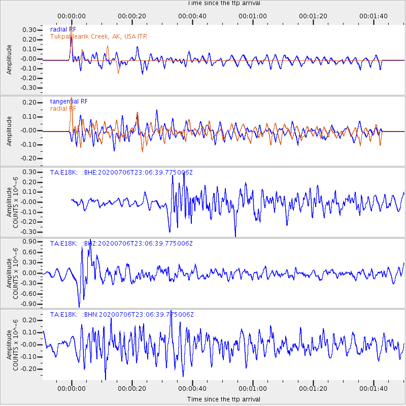
E18K Tukpahlearik Creek, AK, USA - Earthquake Result Viewer
*The percent match for this event was below the threshold and hence no stack was calculated.
| Earthquake location: |
Java Sea |
| Earthquake latitude/longitude: |
-5.6/110.7 |
| Earthquake time(UTC): |
2020/07/06 (188) 22:54:46 GMT |
| Earthquake Depth: |
529 km |
| Earthquake Magnitude: |
6.6 Mww |
| Earthquake Catalog/Contributor: |
NEIC PDE/us |
|
| Network: |
TA USArray Transportable Network (new EarthScope stations) |
| Station: |
E18K Tukpahlearik Creek, AK, USA |
| Lat/Lon: |
67.42 N/160.60 W |
| Elevation: |
297 m |
|
| Distance: |
94.7 deg |
| Az: |
22.789 deg |
| Baz: |
266.652 deg |
| Ray Param: |
$rayparam |
*The percent match for this event was below the threshold and hence was not used in the summary stack. |
|
| Radial Match: |
69.380104 % |
| Radial Bump: |
400 |
| Transverse Match: |
72.269844 % |
| Transverse Bump: |
400 |
| SOD ConfigId: |
21709731 |
| Insert Time: |
2020-07-20 23:02:27.117 +0000 |
| GWidth: |
2.5 |
| Max Bumps: |
400 |
| Tol: |
0.001 |
|
Signal To Noise
| Channel | StoN | STA | LTA |
| TA:E18K: :BHZ:20200706T23:06:39.775006Z | 6.7027793 | 4.1327388E-7 | 6.165709E-8 |
| TA:E18K: :BHN:20200706T23:06:39.775006Z | 1.7125674 | 9.223804E-8 | 5.3859505E-8 |
| TA:E18K: :BHE:20200706T23:06:39.775006Z | 4.1145687 | 1.2823023E-7 | 3.1164927E-8 |
| Arrivals |
| Ps | |
| PpPs | |
| PsPs/PpSs | |


