You are here: Home > Network List > TA - USArray Transportable Network (new EarthScope stations) Stations List
> Station I17K Unalakleet, AK, USA > Earthquake Result Viewer
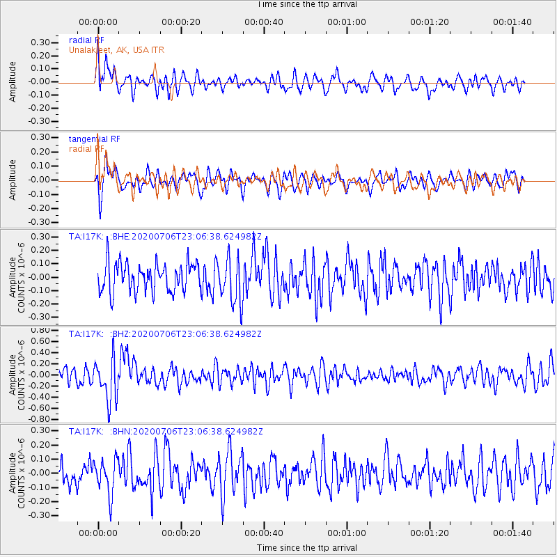
I17K Unalakleet, AK, USA - Earthquake Result Viewer
*The percent match for this event was below the threshold and hence no stack was calculated.
| Earthquake location: |
Java Sea |
| Earthquake latitude/longitude: |
-5.6/110.7 |
| Earthquake time(UTC): |
2020/07/06 (188) 22:54:46 GMT |
| Earthquake Depth: |
529 km |
| Earthquake Magnitude: |
6.6 Mww |
| Earthquake Catalog/Contributor: |
NEIC PDE/us |
|
| Network: |
TA USArray Transportable Network (new EarthScope stations) |
| Station: |
I17K Unalakleet, AK, USA |
| Lat/Lon: |
63.89 N/160.70 W |
| Elevation: |
105 m |
|
| Distance: |
94.4 deg |
| Az: |
26.342 deg |
| Baz: |
266.287 deg |
| Ray Param: |
$rayparam |
*The percent match for this event was below the threshold and hence was not used in the summary stack. |
|
| Radial Match: |
59.695168 % |
| Radial Bump: |
400 |
| Transverse Match: |
56.63408 % |
| Transverse Bump: |
400 |
| SOD ConfigId: |
21709731 |
| Insert Time: |
2020-07-20 23:02:48.556 +0000 |
| GWidth: |
2.5 |
| Max Bumps: |
400 |
| Tol: |
0.001 |
|
Signal To Noise
| Channel | StoN | STA | LTA |
| TA:I17K: :BHZ:20200706T23:06:38.624982Z | 3.5895116 | 3.8484177E-7 | 1.0721285E-7 |
| TA:I17K: :BHN:20200706T23:06:38.624982Z | 1.2433219 | 1.2707035E-7 | 1.0220229E-7 |
| TA:I17K: :BHE:20200706T23:06:38.624982Z | 1.6554221 | 1.7428172E-7 | 1.0527933E-7 |
| Arrivals |
| Ps | |
| PpPs | |
| PsPs/PpSs | |


