You are here: Home > Network List > AV - Alaska Volcano Observatory Stations List
> Station MAPS Pakushin Southeast, Makushin Volcano, Alaska > Earthquake Result Viewer
MAPS Pakushin Southeast, Makushin Volcano, Alaska - Earthquake Result Viewer
*The percent match for this event was below the threshold and hence no stack was calculated.
| Earthquake location: |
Flores Sea |
| Earthquake latitude/longitude: |
-7.2/120.4 |
| Earthquake time(UTC): |
2020/07/14 (196) 23:33:58 GMT |
| Earthquake Depth: |
599 km |
| Earthquake Magnitude: |
5.7 Mww |
| Earthquake Catalog/Contributor: |
NEIC PDE/us |
|
| Network: |
AV Alaska Volcano Observatory |
| Station: |
MAPS Pakushin Southeast, Makushin Volcano, Alaska |
| Lat/Lon: |
53.81 N/166.94 W |
| Elevation: |
333 m |
|
| Distance: |
85.7 deg |
| Az: |
34.58 deg |
| Baz: |
251.704 deg |
| Ray Param: |
$rayparam |
*The percent match for this event was below the threshold and hence was not used in the summary stack. |
|
| Radial Match: |
69.21065 % |
| Radial Bump: |
400 |
| Transverse Match: |
53.56947 % |
| Transverse Bump: |
400 |
| SOD ConfigId: |
21709731 |
| Insert Time: |
2020-07-28 23:35:52.264 +0000 |
| GWidth: |
2.5 |
| Max Bumps: |
400 |
| Tol: |
0.001 |
|
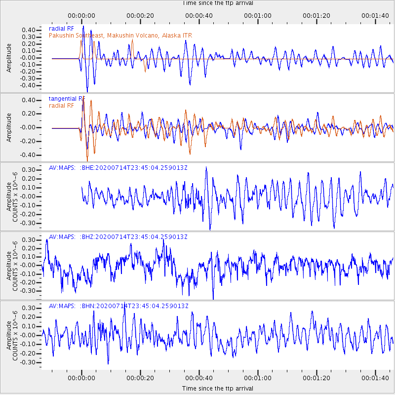
Signal To Noise
| Channel | StoN | STA | LTA |
| AV:MAPS: :BHZ:20200714T23:45:04.259013Z | 1.5751508 | 1.5375305E-7 | 9.761163E-8 |
| AV:MAPS: :BHN:20200714T23:45:04.259013Z | 1.3257855 | 1.01403785E-7 | 7.648581E-8 |
| AV:MAPS: :BHE:20200714T23:45:04.259013Z | 1.4802208 | 9.6459075E-8 | 6.516533E-8 |
| Arrivals |
| Ps | |
| PpPs | |
| PsPs/PpSs | |


