You are here: Home > Network List > IU - Global Seismograph Network (GSN - IRIS/USGS) Stations List
> Station CTAO Charters Towers, Australia > Earthquake Result Viewer
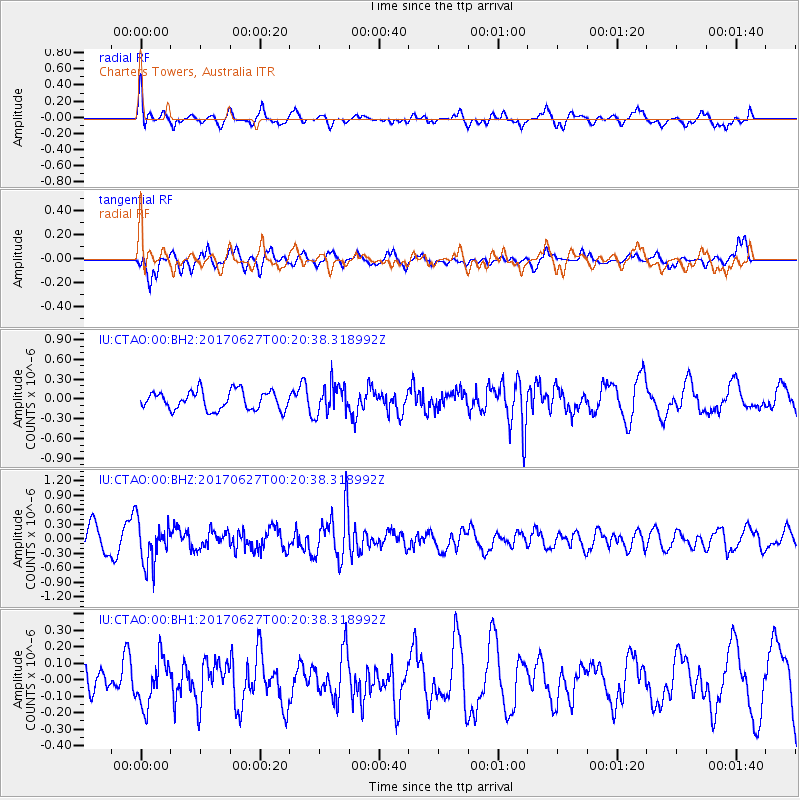
CTAO Charters Towers, Australia - Earthquake Result Viewer
*The percent match for this event was below the threshold and hence no stack was calculated.
| Earthquake location: |
South Of Fiji Islands |
| Earthquake latitude/longitude: |
-24.8/-177.2 |
| Earthquake time(UTC): |
2017/06/27 (178) 00:14:37 GMT |
| Earthquake Depth: |
132 km |
| Earthquake Magnitude: |
5.5 Mww |
| Earthquake Catalog/Contributor: |
NEIC PDE/us |
|
| Network: |
IU Global Seismograph Network (GSN - IRIS/USGS) |
| Station: |
CTAO Charters Towers, Australia |
| Lat/Lon: |
20.09 S/146.25 E |
| Elevation: |
357 m |
|
| Distance: |
34.0 deg |
| Az: |
270.471 deg |
| Baz: |
104.762 deg |
| Ray Param: |
$rayparam |
*The percent match for this event was below the threshold and hence was not used in the summary stack. |
|
| Radial Match: |
65.97214 % |
| Radial Bump: |
400 |
| Transverse Match: |
66.19194 % |
| Transverse Bump: |
363 |
| SOD ConfigId: |
2140511 |
| Insert Time: |
2017-07-14 22:10:41.815 +0000 |
| GWidth: |
2.5 |
| Max Bumps: |
400 |
| Tol: |
0.001 |
|
Signal To Noise
| Channel | StoN | STA | LTA |
| IU:CTAO:00:BHZ:20170627T00:20:38.318992Z | 2.1709676 | 4.4112298E-7 | 2.0319187E-7 |
| IU:CTAO:00:BH1:20170627T00:20:38.318992Z | 0.93935 | 1.4291639E-7 | 1.5214393E-7 |
| IU:CTAO:00:BH2:20170627T00:20:38.318992Z | 1.5711105 | 2.2284851E-7 | 1.418414E-7 |
| Arrivals |
| Ps | |
| PpPs | |
| PsPs/PpSs | |


