You are here: Home > Network List > IU - Global Seismograph Network (GSN - IRIS/USGS) Stations List
> Station PMG Port Moresby, New Guinea > Earthquake Result Viewer
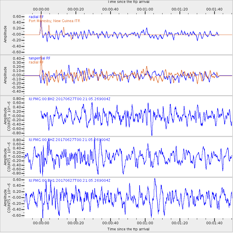
PMG Port Moresby, New Guinea - Earthquake Result Viewer
*The percent match for this event was below the threshold and hence no stack was calculated.
| Earthquake location: |
South Of Fiji Islands |
| Earthquake latitude/longitude: |
-24.8/-177.2 |
| Earthquake time(UTC): |
2017/06/27 (178) 00:14:37 GMT |
| Earthquake Depth: |
132 km |
| Earthquake Magnitude: |
5.5 Mww |
| Earthquake Catalog/Contributor: |
NEIC PDE/us |
|
| Network: |
IU Global Seismograph Network (GSN - IRIS/USGS) |
| Station: |
PMG Port Moresby, New Guinea |
| Lat/Lon: |
9.40 S/147.16 E |
| Elevation: |
90 m |
|
| Distance: |
37.2 deg |
| Az: |
288.014 deg |
| Baz: |
118.839 deg |
| Ray Param: |
$rayparam |
*The percent match for this event was below the threshold and hence was not used in the summary stack. |
|
| Radial Match: |
59.02225 % |
| Radial Bump: |
400 |
| Transverse Match: |
53.392292 % |
| Transverse Bump: |
400 |
| SOD ConfigId: |
2140511 |
| Insert Time: |
2017-07-14 22:10:49.441 +0000 |
| GWidth: |
2.5 |
| Max Bumps: |
400 |
| Tol: |
0.001 |
|
Signal To Noise
| Channel | StoN | STA | LTA |
| IU:PMG:00:BHZ:20170627T00:21:05.269004Z | 2.487985 | 4.1254893E-7 | 1.6581649E-7 |
| IU:PMG:00:BH1:20170627T00:21:05.269004Z | 1.6816393 | 2.58935E-7 | 1.5397772E-7 |
| IU:PMG:00:BH2:20170627T00:21:05.269004Z | 1.21581 | 2.783995E-7 | 2.2898277E-7 |
| Arrivals |
| Ps | |
| PpPs | |
| PsPs/PpSs | |


