You are here: Home > Network List > TA - USArray Transportable Network (new EarthScope stations) Stations List
> Station H16K Elim, AK, USA > Earthquake Result Viewer
H16K Elim, AK, USA - Earthquake Result Viewer

| Earthquake location: |
Panama |
| Earthquake latitude/longitude: |
7.5/-81.9 |
| Earthquake time(UTC): |
2020/07/15 (197) 21:39:40 GMT |
| Earthquake Depth: |
5.7 km |
| Earthquake Magnitude: |
5.8 mww |
| Earthquake Catalog/Contributor: |
NEIC PDE/us |
|
| Network: |
TA USArray Transportable Network (new EarthScope stations) |
| Station: |
H16K Elim, AK, USA |
| Lat/Lon: |
64.64 N/162.24 W |
| Elevation: |
216 m |
|
| Distance: |
79.1 deg |
| Az: |
334.387 deg |
| Baz: |
95.545 deg |
| Ray Param: |
0.04917792 |
| Estimated Moho Depth: |
28.25 km |
| Estimated Crust Vp/Vs: |
2.03 |
| Assumed Crust Vp: |
6.276 km/s |
| Estimated Crust Vs: |
3.095 km/s |
| Estimated Crust Poisson's Ratio: |
0.34 |
|
| Radial Match: |
87.83262 % |
| Radial Bump: |
400 |
| Transverse Match: |
70.918594 % |
| Transverse Bump: |
400 |
| SOD ConfigId: |
21709731 |
| Insert Time: |
2020-07-29 22:04:55.638 +0000 |
| GWidth: |
2.5 |
| Max Bumps: |
400 |
| Tol: |
0.001 |
|
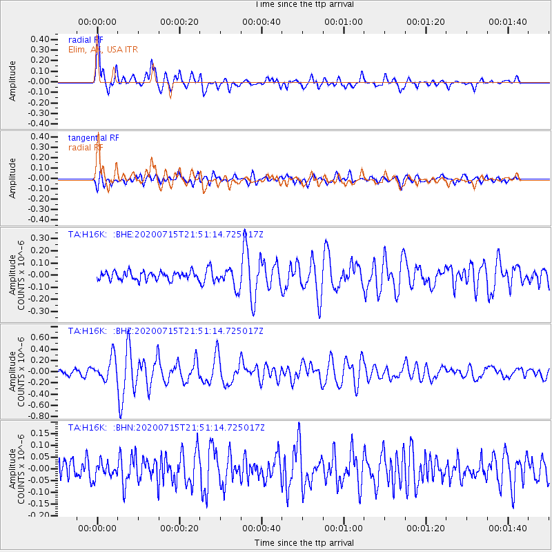
Signal To Noise
| Channel | StoN | STA | LTA |
| TA:H16K: :BHZ:20200715T21:51:14.725017Z | 3.7365754 | 2.1048021E-7 | 5.632971E-8 |
| TA:H16K: :BHN:20200715T21:51:14.725017Z | 0.79063565 | 2.962893E-8 | 3.7474823E-8 |
| TA:H16K: :BHE:20200715T21:51:14.725017Z | 2.4702036 | 8.08511E-8 | 3.273054E-8 |
| Arrivals |
| Ps | 4.7 SECOND |
| PpPs | 13 SECOND |
| PsPs/PpSs | 18 SECOND |


