You are here: Home > Network List > AV - Alaska Volcano Observatory Stations List
> Station AUSS Augustine Summit Station, Augustine Volcano, Alaska > Earthquake Result Viewer
AUSS Augustine Summit Station, Augustine Volcano, Alaska - Earthquake Result Viewer
| Earthquake location: |
Eastern New Guinea Reg., P.N.G. |
| Earthquake latitude/longitude: |
-7.8/147.8 |
| Earthquake time(UTC): |
2020/07/17 (199) 02:50:23 GMT |
| Earthquake Depth: |
85 km |
| Earthquake Magnitude: |
6.9 mww |
| Earthquake Catalog/Contributor: |
NEIC PDE/us |
|
| Network: |
AV Alaska Volcano Observatory |
| Station: |
AUSS Augustine Summit Station, Augustine Volcano, Alaska |
| Lat/Lon: |
59.36 N/153.43 W |
| Elevation: |
1235 m |
|
| Distance: |
81.6 deg |
| Az: |
26.292 deg |
| Baz: |
238.96 deg |
| Ray Param: |
0.04730174 |
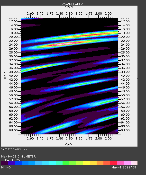
| Estimated Moho Depth: |
23.5 km |
| Estimated Crust Vp/Vs: |
1.81 |
| Assumed Crust Vp: |
5.989 km/s |
| Estimated Crust Vs: |
3.304 km/s |
| Estimated Crust Poisson's Ratio: |
0.28 |
|
| Radial Match: |
90.579636 % |
| Radial Bump: |
347 |
| Transverse Match: |
87.144615 % |
| Transverse Bump: |
362 |
| SOD ConfigId: |
21709731 |
| Insert Time: |
2020-07-31 02:55:22.697 +0000 |
| GWidth: |
2.5 |
| Max Bumps: |
400 |
| Tol: |
0.001 |
|
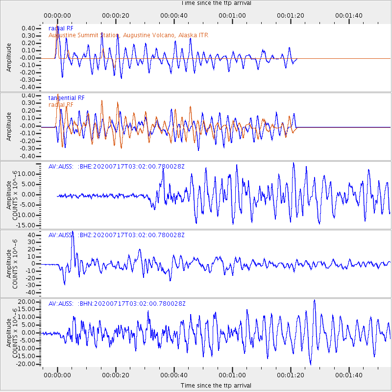
Signal To Noise
| Channel | StoN | STA | LTA |
| AV:AUSS: :BHZ:20200717T03:02:00.780028Z | 46.673122 | 1.0048473E-5 | 2.1529463E-7 |
| AV:AUSS: :BHN:20200717T03:02:00.780028Z | 5.246602 | 2.4538483E-6 | 4.6770236E-7 |
| AV:AUSS: :BHE:20200717T03:02:00.780028Z | 6.2855134 | 2.9223309E-6 | 4.6493113E-7 |
| Arrivals |
| Ps | 3.3 SECOND |
| PpPs | 11 SECOND |
| PsPs/PpSs | 14 SECOND |


