You are here: Home > Network List > CI - Caltech Regional Seismic Network Stations List
> Station MPP McPhearson Peak > Earthquake Result Viewer
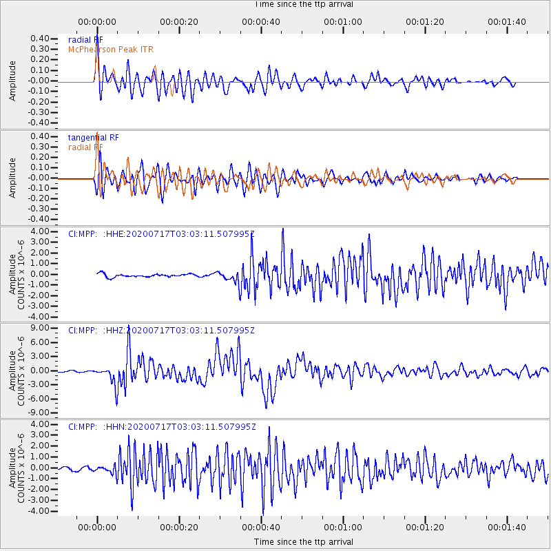
MPP McPhearson Peak - Earthquake Result Viewer
*The percent match for this event was below the threshold and hence no stack was calculated.
| Earthquake location: |
Eastern New Guinea Reg., P.N.G. |
| Earthquake latitude/longitude: |
-7.8/147.8 |
| Earthquake time(UTC): |
2020/07/17 (199) 02:50:23 GMT |
| Earthquake Depth: |
85 km |
| Earthquake Magnitude: |
6.9 mww |
| Earthquake Catalog/Contributor: |
NEIC PDE/us |
|
| Network: |
CI Caltech Regional Seismic Network |
| Station: |
MPP McPhearson Peak |
| Lat/Lon: |
34.89 N/119.81 W |
| Elevation: |
1739 m |
|
| Distance: |
96.4 deg |
| Az: |
55.741 deg |
| Baz: |
264.945 deg |
| Ray Param: |
$rayparam |
*The percent match for this event was below the threshold and hence was not used in the summary stack. |
|
| Radial Match: |
87.571396 % |
| Radial Bump: |
400 |
| Transverse Match: |
88.381 % |
| Transverse Bump: |
400 |
| SOD ConfigId: |
21709731 |
| Insert Time: |
2020-07-31 02:59:13.847 +0000 |
| GWidth: |
2.5 |
| Max Bumps: |
400 |
| Tol: |
0.001 |
|
Signal To Noise
| Channel | StoN | STA | LTA |
| CI:MPP: :HHZ:20200717T03:03:11.507995Z | 12.417524 | 2.0455157E-6 | 1.6472814E-7 |
| CI:MPP: :HHN:20200717T03:03:11.507995Z | 1.9790802 | 3.5091054E-7 | 1.7730991E-7 |
| CI:MPP: :HHE:20200717T03:03:11.507995Z | 3.8100762 | 5.538928E-7 | 1.4537576E-7 |
| Arrivals |
| Ps | |
| PpPs | |
| PsPs/PpSs | |


