You are here: Home > Network List > XD94 - Tanzania BB Experiment Stations List
> Station GOMA XD.GOMA > Earthquake Result Viewer
GOMA XD.GOMA - Earthquake Result Viewer

| Earthquake location: |
Myanmar |
| Earthquake latitude/longitude: |
24.7/95.2 |
| Earthquake time(UTC): |
1994/08/08 (220) 21:08:31 GMT |
| Earthquake Depth: |
127 km |
| Earthquake Magnitude: |
6.0 MB, 5.1 UNKNOWN, 6.1 MW |
| Earthquake Catalog/Contributor: |
WHDF/NEIC |
|
| Network: |
XD Tanzania BB Experiment |
| Station: |
GOMA XD.GOMA |
| Lat/Lon: |
4.84 S/29.69 E |
| Elevation: |
880 m |
|
| Distance: |
70.1 deg |
| Az: |
254.716 deg |
| Baz: |
61.688 deg |
| Ray Param: |
0.05488138 |
| Estimated Moho Depth: |
35.0 km |
| Estimated Crust Vp/Vs: |
1.97 |
| Assumed Crust Vp: |
6.41 km/s |
| Estimated Crust Vs: |
3.262 km/s |
| Estimated Crust Poisson's Ratio: |
0.33 |
|
| Radial Match: |
95.592445 % |
| Radial Bump: |
390 |
| Transverse Match: |
84.330124 % |
| Transverse Bump: |
400 |
| SOD ConfigId: |
16938 |
| Insert Time: |
2010-03-08 22:47:45.862 +0000 |
| GWidth: |
2.5 |
| Max Bumps: |
400 |
| Tol: |
0.001 |
|
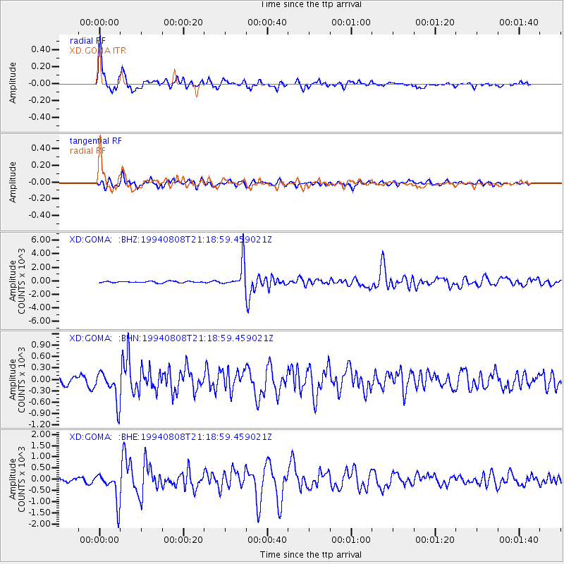
Signal To Noise
| Channel | StoN | STA | LTA |
| XD:GOMA: :BHN:19940808T21:18:59.459021Z | 4.842599 | 418.12952 | 86.344025 |
| XD:GOMA: :BHE:19940808T21:18:59.459021Z | 6.0875607 | 701.5306 | 115.24001 |
| XD:GOMA: :BHZ:19940808T21:18:59.459021Z | 19.222635 | 1980.3513 | 103.02185 |
| Arrivals |
| Ps | 5.4 SECOND |
| PpPs | 16 SECOND |
| PsPs/PpSs | 21 SECOND |


