You are here: Home > Network List > CI - Caltech Regional Seismic Network Stations List
> Station SWS Sam W. Stewart, Westmorland, CA, USA > Earthquake Result Viewer
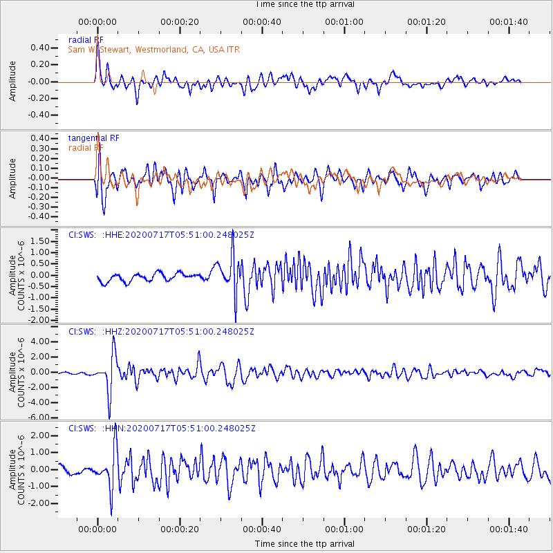
SWS Sam W. Stewart, Westmorland, CA, USA - Earthquake Result Viewer
*The percent match for this event was below the threshold and hence no stack was calculated.
| Earthquake location: |
Near Coast Of Northern Chile |
| Earthquake latitude/longitude: |
-20.2/-70.1 |
| Earthquake time(UTC): |
2020/07/17 (199) 05:40:36 GMT |
| Earthquake Depth: |
74 km |
| Earthquake Magnitude: |
5.9 Mww |
| Earthquake Catalog/Contributor: |
NEIC PDE/us |
|
| Network: |
CI Caltech Regional Seismic Network |
| Station: |
SWS Sam W. Stewart, Westmorland, CA, USA |
| Lat/Lon: |
32.94 N/115.80 W |
| Elevation: |
140 m |
|
| Distance: |
68.5 deg |
| Az: |
319.747 deg |
| Baz: |
133.816 deg |
| Ray Param: |
$rayparam |
*The percent match for this event was below the threshold and hence was not used in the summary stack. |
|
| Radial Match: |
80.76489 % |
| Radial Bump: |
400 |
| Transverse Match: |
86.49836 % |
| Transverse Bump: |
400 |
| SOD ConfigId: |
21709731 |
| Insert Time: |
2020-07-31 05:47:06.297 +0000 |
| GWidth: |
2.5 |
| Max Bumps: |
400 |
| Tol: |
0.001 |
|
Signal To Noise
| Channel | StoN | STA | LTA |
| CI:SWS: :HHZ:20200717T05:51:00.248025Z | 21.691244 | 2.4533401E-6 | 1.1310278E-7 |
| CI:SWS: :HHN:20200717T05:51:00.248025Z | 5.2689476 | 1.1712136E-6 | 2.2228606E-7 |
| CI:SWS: :HHE:20200717T05:51:00.248025Z | 4.7098775 | 8.204967E-7 | 1.7420766E-7 |
| Arrivals |
| Ps | |
| PpPs | |
| PsPs/PpSs | |


