You are here: Home > Network List > G - GEOSCOPE Stations List
> Station WUS Wushi, Xinjiang Uygur, China > Earthquake Result Viewer
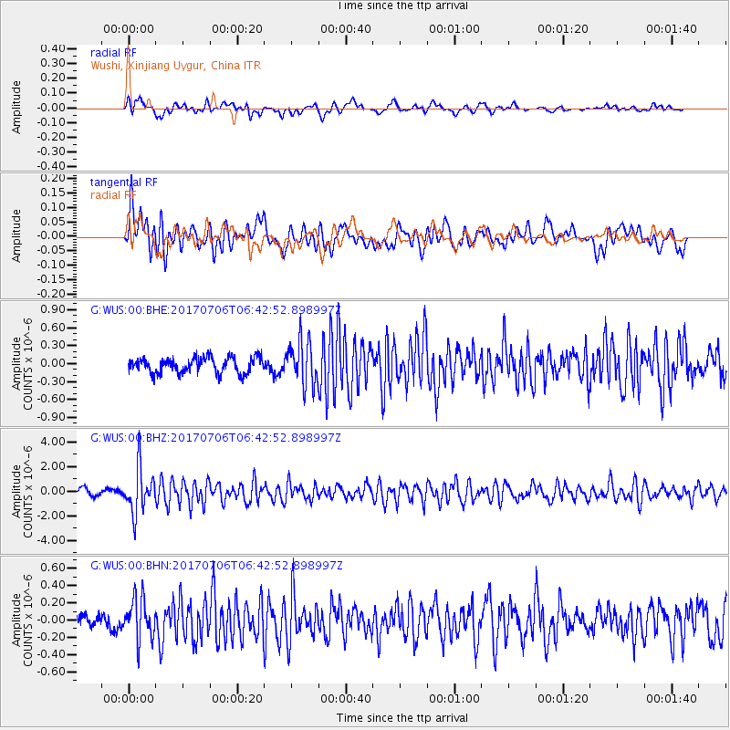
WUS Wushi, Xinjiang Uygur, China - Earthquake Result Viewer
*The percent match for this event was below the threshold and hence no stack was calculated.
| Earthquake location: |
Montana |
| Earthquake latitude/longitude: |
46.9/-112.6 |
| Earthquake time(UTC): |
2017/07/06 (187) 06:30:16 GMT |
| Earthquake Depth: |
4.3 km |
| Earthquake Magnitude: |
5.8 Mww |
| Earthquake Catalog/Contributor: |
NEIC PDE/us |
|
| Network: |
G GEOSCOPE |
| Station: |
WUS Wushi, Xinjiang Uygur, China |
| Lat/Lon: |
41.20 N/79.22 E |
| Elevation: |
1457 m |
|
| Distance: |
91.7 deg |
| Az: |
351.116 deg |
| Baz: |
8.067 deg |
| Ray Param: |
$rayparam |
*The percent match for this event was below the threshold and hence was not used in the summary stack. |
|
| Radial Match: |
76.53311 % |
| Radial Bump: |
400 |
| Transverse Match: |
67.22279 % |
| Transverse Bump: |
400 |
| SOD ConfigId: |
2140511 |
| Insert Time: |
2017-07-19 22:23:19.539 +0000 |
| GWidth: |
2.5 |
| Max Bumps: |
400 |
| Tol: |
0.001 |
|
Signal To Noise
| Channel | StoN | STA | LTA |
| G:WUS:00:BHZ:20170706T06:42:52.898997Z | 6.7272205 | 1.8267518E-6 | 2.715463E-7 |
| G:WUS:00:BHN:20170706T06:42:52.898997Z | 3.8343136 | 2.413387E-7 | 6.294182E-8 |
| G:WUS:00:BHE:20170706T06:42:52.898997Z | 2.7884426 | 3.6152218E-7 | 1.2965022E-7 |
| Arrivals |
| Ps | |
| PpPs | |
| PsPs/PpSs | |


