You are here: Home > Network List > TA - USArray Transportable Network (new EarthScope stations) Stations List
> Station R33M Jennings River, BC, CAN > Earthquake Result Viewer
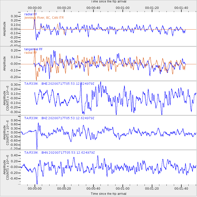
R33M Jennings River, BC, CAN - Earthquake Result Viewer
*The percent match for this event was below the threshold and hence no stack was calculated.
| Earthquake location: |
Near Coast Of Northern Chile |
| Earthquake latitude/longitude: |
-20.2/-70.1 |
| Earthquake time(UTC): |
2020/07/17 (199) 05:40:36 GMT |
| Earthquake Depth: |
74 km |
| Earthquake Magnitude: |
5.9 Mww |
| Earthquake Catalog/Contributor: |
NEIC PDE/us |
|
| Network: |
TA USArray Transportable Network (new EarthScope stations) |
| Station: |
R33M Jennings River, BC, CAN |
| Lat/Lon: |
59.39 N/130.97 W |
| Elevation: |
1437 m |
|
| Distance: |
93.5 deg |
| Az: |
333.41 deg |
| Baz: |
124.769 deg |
| Ray Param: |
$rayparam |
*The percent match for this event was below the threshold and hence was not used in the summary stack. |
|
| Radial Match: |
44.978302 % |
| Radial Bump: |
400 |
| Transverse Match: |
58.486996 % |
| Transverse Bump: |
400 |
| SOD ConfigId: |
21709731 |
| Insert Time: |
2020-07-31 06:06:08.683 +0000 |
| GWidth: |
2.5 |
| Max Bumps: |
400 |
| Tol: |
0.001 |
|
Signal To Noise
| Channel | StoN | STA | LTA |
| TA:R33M: :BHZ:20200717T05:53:12.624979Z | 4.4136124 | 4.3267855E-7 | 9.803274E-8 |
| TA:R33M: :BHN:20200717T05:53:12.624979Z | 2.7960823 | 2.360879E-7 | 8.443524E-8 |
| TA:R33M: :BHE:20200717T05:53:12.624979Z | 2.094865 | 2.1230035E-7 | 1.0134321E-7 |
| Arrivals |
| Ps | |
| PpPs | |
| PsPs/PpSs | |


