You are here: Home > Network List > PF - Volcanologic Network of Piton de Fournaise-OVPF Stations List
> Station FRE Station Sismologique des Fonds de la Riviere de l'Est > Earthquake Result Viewer
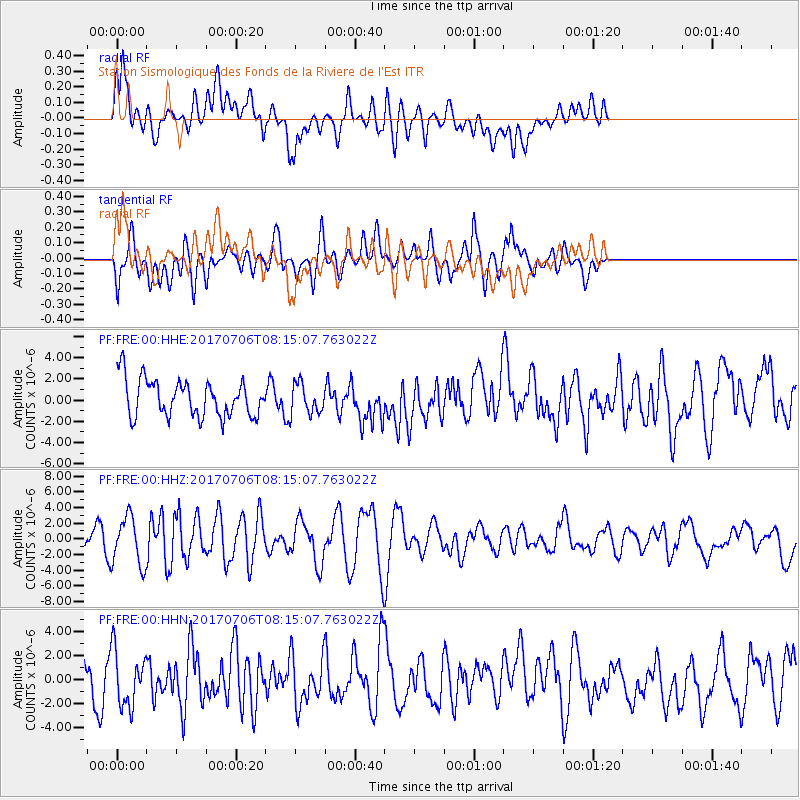
FRE Station Sismologique des Fonds de la Riviere de l'Est - Earthquake Result Viewer
*The percent match for this event was below the threshold and hence no stack was calculated.
| Earthquake location: |
Leyte, Philippines |
| Earthquake latitude/longitude: |
11.1/124.6 |
| Earthquake time(UTC): |
2017/07/06 (187) 08:03:57 GMT |
| Earthquake Depth: |
6.5 km |
| Earthquake Magnitude: |
6.5 mww |
| Earthquake Catalog/Contributor: |
NEIC PDE/us |
|
| Network: |
PF Volcanologic Network of Piton de Fournaise-OVPF |
| Station: |
FRE Station Sismologique des Fonds de la Riviere de l'Est |
| Lat/Lon: |
21.20 S/55.70 E |
| Elevation: |
1775 m |
|
| Distance: |
74.9 deg |
| Az: |
244.405 deg |
| Baz: |
71.552 deg |
| Ray Param: |
$rayparam |
*The percent match for this event was below the threshold and hence was not used in the summary stack. |
|
| Radial Match: |
61.321114 % |
| Radial Bump: |
400 |
| Transverse Match: |
61.51249 % |
| Transverse Bump: |
400 |
| SOD ConfigId: |
2140511 |
| Insert Time: |
2017-07-20 00:00:31.441 +0000 |
| GWidth: |
2.5 |
| Max Bumps: |
400 |
| Tol: |
0.001 |
|
Signal To Noise
| Channel | StoN | STA | LTA |
| PF:FRE:00:HHZ:20170706T08:15:07.763022Z | 2.531544 | 3.0753802E-6 | 1.2148239E-6 |
| PF:FRE:00:HHN:20170706T08:15:07.763022Z | 1.1844059 | 2.2931833E-6 | 1.9361464E-6 |
| PF:FRE:00:HHE:20170706T08:15:07.763022Z | 0.82738525 | 1.452921E-6 | 1.7560392E-6 |
| Arrivals |
| Ps | |
| PpPs | |
| PsPs/PpSs | |


