You are here: Home > Network List > TA - USArray Transportable Network (new EarthScope stations) Stations List
> Station F21K Alatna River, AK, USA > Earthquake Result Viewer
F21K Alatna River, AK, USA - Earthquake Result Viewer
*The percent match for this event was below the threshold and hence no stack was calculated.
| Earthquake location: |
Andaman Islands, India Region |
| Earthquake latitude/longitude: |
12.1/94.9 |
| Earthquake time(UTC): |
2020/07/17 (199) 18:32:59 GMT |
| Earthquake Depth: |
10 km |
| Earthquake Magnitude: |
5.7 mww |
| Earthquake Catalog/Contributor: |
NEIC PDE/us |
|
| Network: |
TA USArray Transportable Network (new EarthScope stations) |
| Station: |
F21K Alatna River, AK, USA |
| Lat/Lon: |
67.22 N/153.48 W |
| Elevation: |
597 m |
|
| Distance: |
87.0 deg |
| Az: |
21.258 deg |
| Baz: |
294.388 deg |
| Ray Param: |
$rayparam |
*The percent match for this event was below the threshold and hence was not used in the summary stack. |
|
| Radial Match: |
67.455475 % |
| Radial Bump: |
400 |
| Transverse Match: |
71.70107 % |
| Transverse Bump: |
400 |
| SOD ConfigId: |
21709731 |
| Insert Time: |
2020-07-31 18:43:30.919 +0000 |
| GWidth: |
2.5 |
| Max Bumps: |
400 |
| Tol: |
0.001 |
|
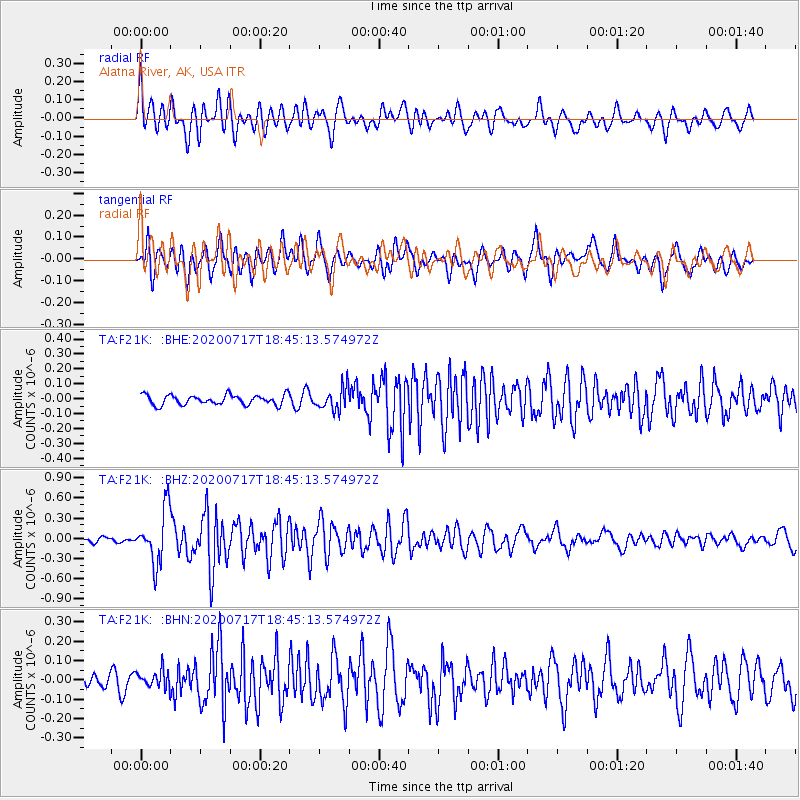
Signal To Noise
| Channel | StoN | STA | LTA |
| TA:F21K: :BHZ:20200717T18:45:13.574972Z | 10.607749 | 3.9552793E-7 | 3.72867E-8 |
| TA:F21K: :BHN:20200717T18:45:13.574972Z | 1.2371231 | 4.389607E-8 | 3.5482376E-8 |
| TA:F21K: :BHE:20200717T18:45:13.574972Z | 2.3182278 | 7.645358E-8 | 3.2979322E-8 |
| Arrivals |
| Ps | |
| PpPs | |
| PsPs/PpSs | |


