You are here: Home > Network List > TA - USArray Transportable Network (new EarthScope stations) Stations List
> Station H31M Peel River, Yukon, CAN > Earthquake Result Viewer
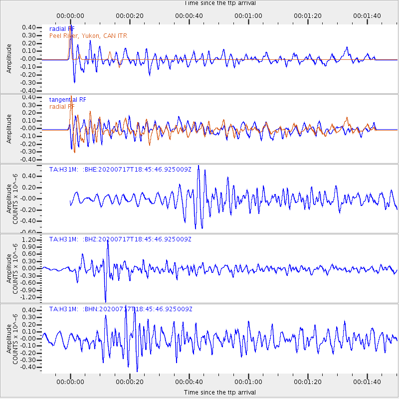
H31M Peel River, Yukon, CAN - Earthquake Result Viewer
*The percent match for this event was below the threshold and hence no stack was calculated.
| Earthquake location: |
Andaman Islands, India Region |
| Earthquake latitude/longitude: |
12.1/94.9 |
| Earthquake time(UTC): |
2020/07/17 (199) 18:32:59 GMT |
| Earthquake Depth: |
10 km |
| Earthquake Magnitude: |
5.7 mww |
| Earthquake Catalog/Contributor: |
NEIC PDE/us |
|
| Network: |
TA USArray Transportable Network (new EarthScope stations) |
| Station: |
H31M Peel River, Yukon, CAN |
| Lat/Lon: |
65.81 N/134.34 W |
| Elevation: |
642 m |
|
| Distance: |
94.2 deg |
| Az: |
18.253 deg |
| Baz: |
311.984 deg |
| Ray Param: |
$rayparam |
*The percent match for this event was below the threshold and hence was not used in the summary stack. |
|
| Radial Match: |
76.40993 % |
| Radial Bump: |
400 |
| Transverse Match: |
72.404755 % |
| Transverse Bump: |
400 |
| SOD ConfigId: |
21709731 |
| Insert Time: |
2020-07-31 18:44:10.421 +0000 |
| GWidth: |
2.5 |
| Max Bumps: |
400 |
| Tol: |
0.001 |
|
Signal To Noise
| Channel | StoN | STA | LTA |
| TA:H31M: :BHZ:20200717T18:45:46.925009Z | 5.2740393 | 2.6883328E-7 | 5.0972943E-8 |
| TA:H31M: :BHN:20200717T18:45:46.925009Z | 0.82874453 | 6.290691E-8 | 7.590628E-8 |
| TA:H31M: :BHE:20200717T18:45:46.925009Z | 1.3135049 | 8.458288E-8 | 6.43948E-8 |
| Arrivals |
| Ps | |
| PpPs | |
| PsPs/PpSs | |


