You are here: Home > Network List > IU - Global Seismograph Network (GSN - IRIS/USGS) Stations List
> Station POHA Pohakuloa, Hawaii, USA > Earthquake Result Viewer
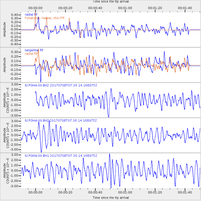
POHA Pohakuloa, Hawaii, USA - Earthquake Result Viewer
*The percent match for this event was below the threshold and hence no stack was calculated.
| Earthquake location: |
Southeast Of Loyalty Islands |
| Earthquake latitude/longitude: |
-22.6/173.1 |
| Earthquake time(UTC): |
2017/07/08 (189) 07:27:35 GMT |
| Earthquake Depth: |
10 km |
| Earthquake Magnitude: |
5.6 Mww |
| Earthquake Catalog/Contributor: |
NEIC PDE/us |
|
| Network: |
IU Global Seismograph Network (GSN - IRIS/USGS) |
| Station: |
POHA Pohakuloa, Hawaii, USA |
| Lat/Lon: |
19.76 N/155.53 W |
| Elevation: |
1990 m |
|
| Distance: |
52.0 deg |
| Az: |
38.432 deg |
| Baz: |
217.589 deg |
| Ray Param: |
$rayparam |
*The percent match for this event was below the threshold and hence was not used in the summary stack. |
|
| Radial Match: |
48.93967 % |
| Radial Bump: |
400 |
| Transverse Match: |
55.430187 % |
| Transverse Bump: |
400 |
| SOD ConfigId: |
2140511 |
| Insert Time: |
2017-07-21 23:20:44.651 +0000 |
| GWidth: |
2.5 |
| Max Bumps: |
400 |
| Tol: |
0.001 |
|
Signal To Noise
| Channel | StoN | STA | LTA |
| IU:POHA:00:BHZ:20170708T07:36:14.168975Z | 2.2464533 | 1.6888528E-6 | 7.517862E-7 |
| IU:POHA:00:BH1:20170708T07:36:14.168975Z | 0.7910459 | 5.9079935E-7 | 7.468585E-7 |
| IU:POHA:00:BH2:20170708T07:36:14.168975Z | 1.1709591 | 9.1683967E-7 | 7.8298183E-7 |
| Arrivals |
| Ps | |
| PpPs | |
| PsPs/PpSs | |


