You are here: Home > Network List > IU - Global Seismograph Network (GSN - IRIS/USGS) Stations List
> Station XMAS Kiritimati Island, Republic of Kiribati > Earthquake Result Viewer
XMAS Kiritimati Island, Republic of Kiribati - Earthquake Result Viewer
*The percent match for this event was below the threshold and hence no stack was calculated.
| Earthquake location: |
Southeast Of Loyalty Islands |
| Earthquake latitude/longitude: |
-22.6/173.1 |
| Earthquake time(UTC): |
2017/07/08 (189) 07:27:35 GMT |
| Earthquake Depth: |
10 km |
| Earthquake Magnitude: |
5.6 Mww |
| Earthquake Catalog/Contributor: |
NEIC PDE/us |
|
| Network: |
IU Global Seismograph Network (GSN - IRIS/USGS) |
| Station: |
XMAS Kiritimati Island, Republic of Kiribati |
| Lat/Lon: |
2.04 N/157.45 W |
| Elevation: |
20 m |
|
| Distance: |
37.7 deg |
| Az: |
53.387 deg |
| Baz: |
227.933 deg |
| Ray Param: |
$rayparam |
*The percent match for this event was below the threshold and hence was not used in the summary stack. |
|
| Radial Match: |
59.870285 % |
| Radial Bump: |
400 |
| Transverse Match: |
59.498867 % |
| Transverse Bump: |
400 |
| SOD ConfigId: |
2140511 |
| Insert Time: |
2017-07-21 23:20:54.430 +0000 |
| GWidth: |
2.5 |
| Max Bumps: |
400 |
| Tol: |
0.001 |
|
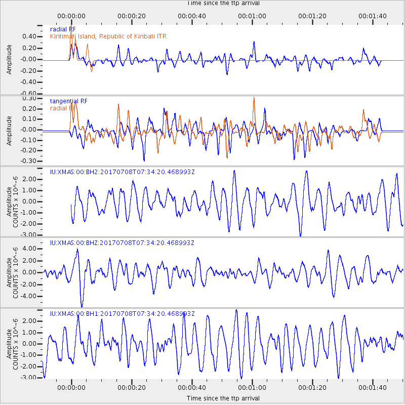
Signal To Noise
| Channel | StoN | STA | LTA |
| IU:XMAS:00:BHZ:20170708T07:34:20.468993Z | 3.394581 | 2.7935105E-6 | 8.229323E-7 |
| IU:XMAS:00:BH1:20170708T07:34:20.468993Z | 0.78322107 | 1.2725626E-6 | 1.6247809E-6 |
| IU:XMAS:00:BH2:20170708T07:34:20.468993Z | 0.58431804 | 5.942905E-7 | 1.0170669E-6 |
| Arrivals |
| Ps | |
| PpPs | |
| PsPs/PpSs | |


