You are here: Home > Network List > AV - Alaska Volcano Observatory Stations List
> Station MNAT Nateekin Bay, Makushin Volcano, Alaska > Earthquake Result Viewer
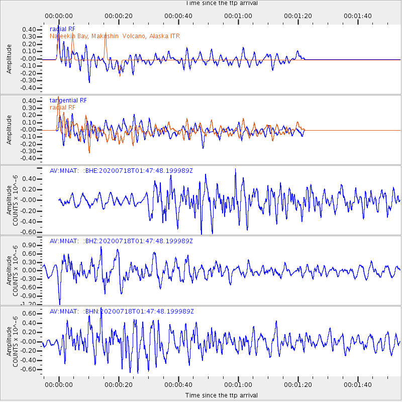
MNAT Nateekin Bay, Makushin Volcano, Alaska - Earthquake Result Viewer
*The percent match for this event was below the threshold and hence no stack was calculated.
| Earthquake location: |
Solomon Islands |
| Earthquake latitude/longitude: |
-10.4/161.4 |
| Earthquake time(UTC): |
2020/07/18 (200) 01:37:14 GMT |
| Earthquake Depth: |
42 km |
| Earthquake Magnitude: |
5.9 Mww |
| Earthquake Catalog/Contributor: |
NEIC PDE/us |
|
| Network: |
AV Alaska Volcano Observatory |
| Station: |
MNAT Nateekin Bay, Makushin Volcano, Alaska |
| Lat/Lon: |
53.88 N/166.69 W |
| Elevation: |
390 m |
|
| Distance: |
69.5 deg |
| Az: |
19.516 deg |
| Baz: |
213.721 deg |
| Ray Param: |
$rayparam |
*The percent match for this event was below the threshold and hence was not used in the summary stack. |
|
| Radial Match: |
65.22083 % |
| Radial Bump: |
400 |
| Transverse Match: |
61.1802 % |
| Transverse Bump: |
400 |
| SOD ConfigId: |
21709731 |
| Insert Time: |
2020-08-01 01:43:12.664 +0000 |
| GWidth: |
2.5 |
| Max Bumps: |
400 |
| Tol: |
0.001 |
|
Signal To Noise
| Channel | StoN | STA | LTA |
| AV:MNAT: :BHZ:20200718T01:47:48.199989Z | 5.3357606 | 4.4289436E-7 | 8.300492E-8 |
| AV:MNAT: :BHN:20200718T01:47:48.199989Z | 2.1369147 | 2.1797248E-7 | 1.0200336E-7 |
| AV:MNAT: :BHE:20200718T01:47:48.199989Z | 2.9632752 | 2.2567156E-7 | 7.615613E-8 |
| Arrivals |
| Ps | |
| PpPs | |
| PsPs/PpSs | |


