You are here: Home > Network List > US - United States National Seismic Network Stations List
> Station ELK Elko, Nevada, USA > Earthquake Result Viewer
ELK Elko, Nevada, USA - Earthquake Result Viewer
*The percent match for this event was below the threshold and hence no stack was calculated.
| Earthquake location: |
Southeast Of Loyalty Islands |
| Earthquake latitude/longitude: |
-22.6/173.1 |
| Earthquake time(UTC): |
2017/07/08 (189) 07:27:35 GMT |
| Earthquake Depth: |
10 km |
| Earthquake Magnitude: |
5.6 Mww |
| Earthquake Catalog/Contributor: |
NEIC PDE/us |
|
| Network: |
US United States National Seismic Network |
| Station: |
ELK Elko, Nevada, USA |
| Lat/Lon: |
40.74 N/115.24 W |
| Elevation: |
2210 m |
|
| Distance: |
91.6 deg |
| Az: |
46.171 deg |
| Baz: |
241.353 deg |
| Ray Param: |
$rayparam |
*The percent match for this event was below the threshold and hence was not used in the summary stack. |
|
| Radial Match: |
73.85479 % |
| Radial Bump: |
400 |
| Transverse Match: |
65.543526 % |
| Transverse Bump: |
400 |
| SOD ConfigId: |
2140511 |
| Insert Time: |
2017-07-21 23:21:26.999 +0000 |
| GWidth: |
2.5 |
| Max Bumps: |
400 |
| Tol: |
0.001 |
|
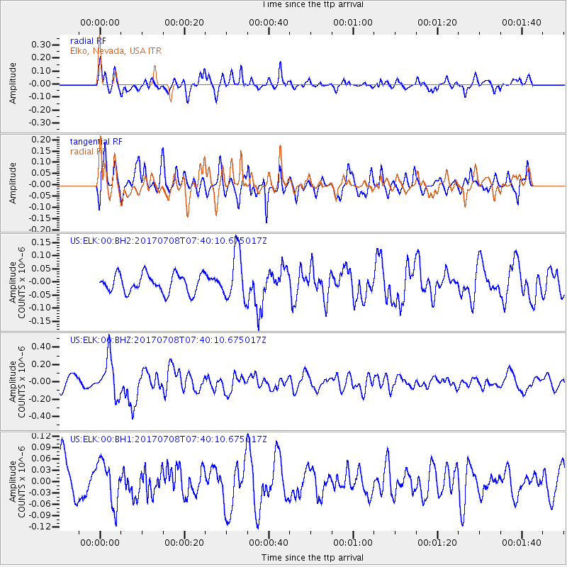
Signal To Noise
| Channel | StoN | STA | LTA |
| US:ELK:00:BHZ:20170708T07:40:10.675017Z | 3.3519228 | 2.2534589E-7 | 6.722885E-8 |
| US:ELK:00:BH1:20170708T07:40:10.675017Z | 1.1122729 | 5.7557504E-8 | 5.1747648E-8 |
| US:ELK:00:BH2:20170708T07:40:10.675017Z | 2.7425075 | 9.512631E-8 | 3.4685886E-8 |
| Arrivals |
| Ps | |
| PpPs | |
| PsPs/PpSs | |


