You are here: Home > Network List > IW - Intermountain West Stations List
> Station PLID Pearl Lake, Idaho, USA > Earthquake Result Viewer
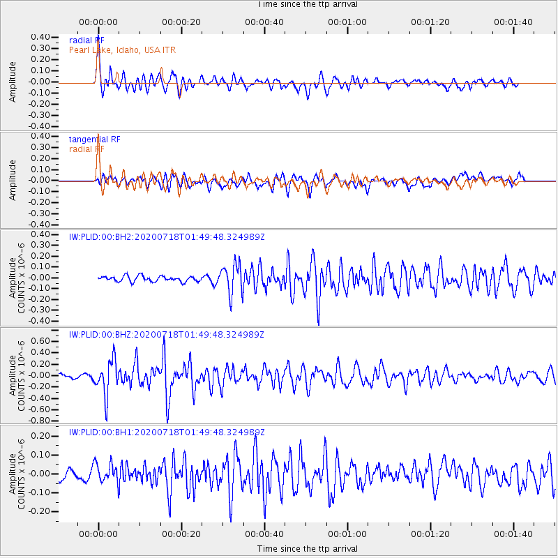
PLID Pearl Lake, Idaho, USA - Earthquake Result Viewer
*The percent match for this event was below the threshold and hence no stack was calculated.
| Earthquake location: |
Solomon Islands |
| Earthquake latitude/longitude: |
-10.4/161.4 |
| Earthquake time(UTC): |
2020/07/18 (200) 01:37:14 GMT |
| Earthquake Depth: |
42 km |
| Earthquake Magnitude: |
5.9 Mww |
| Earthquake Catalog/Contributor: |
NEIC PDE/us |
|
| Network: |
IW Intermountain West |
| Station: |
PLID Pearl Lake, Idaho, USA |
| Lat/Lon: |
45.09 N/116.00 W |
| Elevation: |
2164 m |
|
| Distance: |
92.1 deg |
| Az: |
44.665 deg |
| Baz: |
257.494 deg |
| Ray Param: |
$rayparam |
*The percent match for this event was below the threshold and hence was not used in the summary stack. |
|
| Radial Match: |
76.806435 % |
| Radial Bump: |
400 |
| Transverse Match: |
66.88327 % |
| Transverse Bump: |
400 |
| SOD ConfigId: |
21709731 |
| Insert Time: |
2020-08-01 01:50:22.525 +0000 |
| GWidth: |
2.5 |
| Max Bumps: |
400 |
| Tol: |
0.001 |
|
Signal To Noise
| Channel | StoN | STA | LTA |
| IW:PLID:00:BHZ:20200718T01:49:48.324989Z | 4.805522 | 3.1047344E-7 | 6.460764E-8 |
| IW:PLID:00:BH1:20200718T01:49:48.324989Z | 1.4095957 | 5.0594476E-8 | 3.58929E-8 |
| IW:PLID:00:BH2:20200718T01:49:48.324989Z | 5.526736 | 1.3827812E-7 | 2.5019855E-8 |
| Arrivals |
| Ps | |
| PpPs | |
| PsPs/PpSs | |


