You are here: Home > Network List > US - United States National Seismic Network Stations List
> Station EGMT Eagleton, Montana, USA > Earthquake Result Viewer
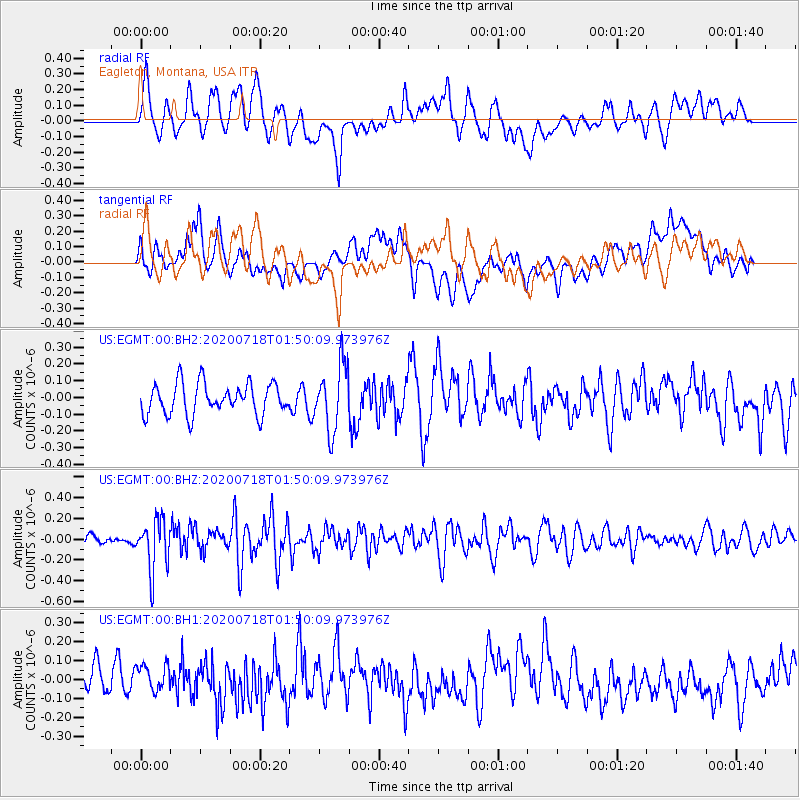
EGMT Eagleton, Montana, USA - Earthquake Result Viewer
*The percent match for this event was below the threshold and hence no stack was calculated.
| Earthquake location: |
Solomon Islands |
| Earthquake latitude/longitude: |
-10.4/161.4 |
| Earthquake time(UTC): |
2020/07/18 (200) 01:37:14 GMT |
| Earthquake Depth: |
42 km |
| Earthquake Magnitude: |
5.9 Mww |
| Earthquake Catalog/Contributor: |
NEIC PDE/us |
|
| Network: |
US United States National Seismic Network |
| Station: |
EGMT Eagleton, Montana, USA |
| Lat/Lon: |
48.02 N/109.75 W |
| Elevation: |
1055 m |
|
| Distance: |
96.9 deg |
| Az: |
42.532 deg |
| Baz: |
262.185 deg |
| Ray Param: |
$rayparam |
*The percent match for this event was below the threshold and hence was not used in the summary stack. |
|
| Radial Match: |
55.21937 % |
| Radial Bump: |
400 |
| Transverse Match: |
54.732517 % |
| Transverse Bump: |
400 |
| SOD ConfigId: |
21709731 |
| Insert Time: |
2020-08-01 01:57:57.762 +0000 |
| GWidth: |
2.5 |
| Max Bumps: |
400 |
| Tol: |
0.001 |
|
Signal To Noise
| Channel | StoN | STA | LTA |
| US:EGMT:00:BHZ:20200718T01:50:09.973976Z | 3.8170137 | 2.4801142E-7 | 6.497525E-8 |
| US:EGMT:00:BH1:20200718T01:50:09.973976Z | 0.8344254 | 6.782304E-8 | 8.128113E-8 |
| US:EGMT:00:BH2:20200718T01:50:09.973976Z | 2.1403868 | 1.9718962E-7 | 9.212803E-8 |
| Arrivals |
| Ps | |
| PpPs | |
| PsPs/PpSs | |


