You are here: Home > Network List > US - United States National Seismic Network Stations List
> Station ELK Elko, Nevada, USA > Earthquake Result Viewer
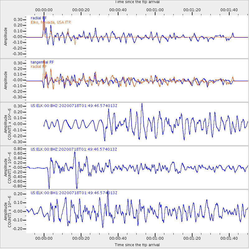
ELK Elko, Nevada, USA - Earthquake Result Viewer
*The percent match for this event was below the threshold and hence no stack was calculated.
| Earthquake location: |
Solomon Islands |
| Earthquake latitude/longitude: |
-10.4/161.4 |
| Earthquake time(UTC): |
2020/07/18 (200) 01:37:14 GMT |
| Earthquake Depth: |
42 km |
| Earthquake Magnitude: |
5.9 Mww |
| Earthquake Catalog/Contributor: |
NEIC PDE/us |
|
| Network: |
US United States National Seismic Network |
| Station: |
ELK Elko, Nevada, USA |
| Lat/Lon: |
40.74 N/115.24 W |
| Elevation: |
2210 m |
|
| Distance: |
91.7 deg |
| Az: |
49.027 deg |
| Baz: |
257.866 deg |
| Ray Param: |
$rayparam |
*The percent match for this event was below the threshold and hence was not used in the summary stack. |
|
| Radial Match: |
75.4272 % |
| Radial Bump: |
400 |
| Transverse Match: |
64.88493 % |
| Transverse Bump: |
395 |
| SOD ConfigId: |
21709731 |
| Insert Time: |
2020-08-01 01:57:58.362 +0000 |
| GWidth: |
2.5 |
| Max Bumps: |
400 |
| Tol: |
0.001 |
|
Signal To Noise
| Channel | StoN | STA | LTA |
| US:ELK:00:BHZ:20200718T01:49:46.574013Z | 9.34256 | 3.2022402E-7 | 3.4275832E-8 |
| US:ELK:00:BH1:20200718T01:49:46.574013Z | 1.0143582 | 5.1194014E-8 | 5.0469367E-8 |
| US:ELK:00:BH2:20200718T01:49:46.574013Z | 2.1340203 | 1.1214803E-7 | 5.2552462E-8 |
| Arrivals |
| Ps | |
| PpPs | |
| PsPs/PpSs | |


