You are here: Home > Network List > UW - Pacific Northwest Regional Seismic Network Stations List
> Station LEBA Lebam, WA, USA > Earthquake Result Viewer
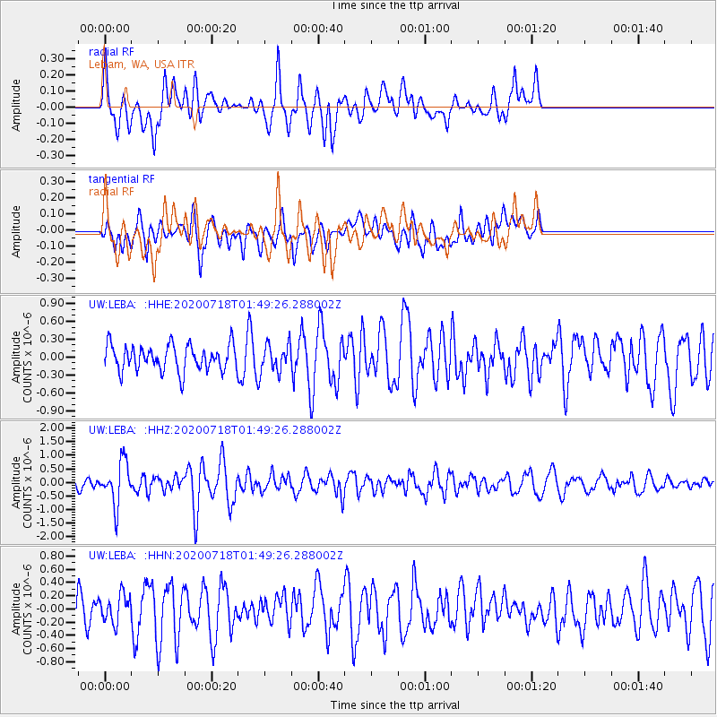
LEBA Lebam, WA, USA - Earthquake Result Viewer
*The percent match for this event was below the threshold and hence no stack was calculated.
| Earthquake location: |
Solomon Islands |
| Earthquake latitude/longitude: |
-10.4/161.4 |
| Earthquake time(UTC): |
2020/07/18 (200) 01:37:14 GMT |
| Earthquake Depth: |
42 km |
| Earthquake Magnitude: |
5.9 Mww |
| Earthquake Catalog/Contributor: |
NEIC PDE/us |
|
| Network: |
UW Pacific Northwest Regional Seismic Network |
| Station: |
LEBA Lebam, WA, USA |
| Lat/Lon: |
46.55 N/123.56 W |
| Elevation: |
73 m |
|
| Distance: |
87.4 deg |
| Az: |
41.873 deg |
| Baz: |
252.071 deg |
| Ray Param: |
$rayparam |
*The percent match for this event was below the threshold and hence was not used in the summary stack. |
|
| Radial Match: |
65.34405 % |
| Radial Bump: |
400 |
| Transverse Match: |
51.989605 % |
| Transverse Bump: |
400 |
| SOD ConfigId: |
21709731 |
| Insert Time: |
2020-08-01 01:59:42.389 +0000 |
| GWidth: |
2.5 |
| Max Bumps: |
400 |
| Tol: |
0.001 |
|
Signal To Noise
| Channel | StoN | STA | LTA |
| UW:LEBA: :HHZ:20200718T01:49:26.288002Z | 4.7732587 | 7.925971E-7 | 1.6604949E-7 |
| UW:LEBA: :HHN:20200718T01:49:26.288002Z | 0.8637917 | 2.1445209E-7 | 2.482683E-7 |
| UW:LEBA: :HHE:20200718T01:49:26.288002Z | 1.0869316 | 2.3465853E-7 | 2.158908E-7 |
| Arrivals |
| Ps | |
| PpPs | |
| PsPs/PpSs | |


