You are here: Home > Network List > AV - Alaska Volcano Observatory Stations List
> Station GSIG Igitkin Island, Great Sitkin Volcano, Alaska > Earthquake Result Viewer
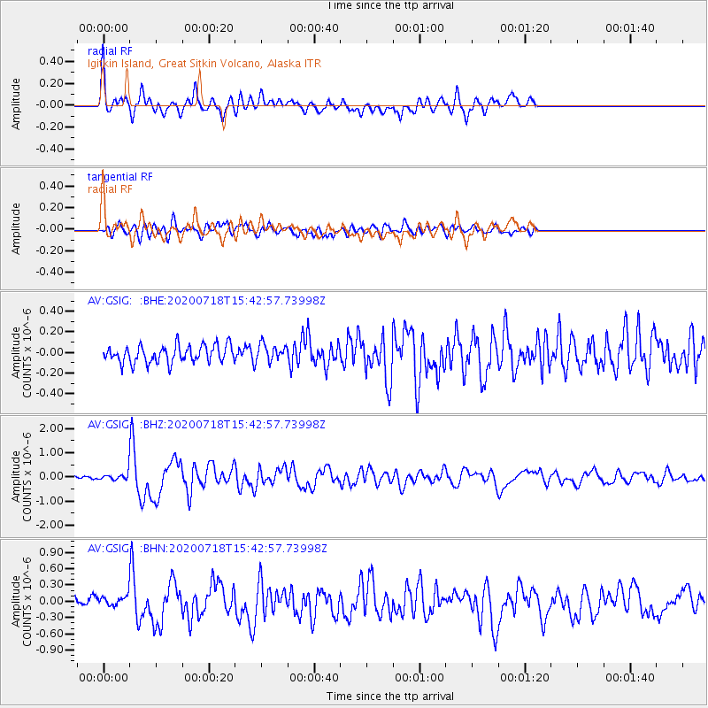
GSIG Igitkin Island, Great Sitkin Volcano, Alaska - Earthquake Result Viewer

| Earthquake location: |
Samoa Islands Region |
| Earthquake latitude/longitude: |
-15.3/-172.6 |
| Earthquake time(UTC): |
2020/07/18 (200) 15:32:35 GMT |
| Earthquake Depth: |
10 km |
| Earthquake Magnitude: |
6.2 Mww |
| Earthquake Catalog/Contributor: |
NEIC PDE/us |
|
| Network: |
AV Alaska Volcano Observatory |
| Station: |
GSIG Igitkin Island, Great Sitkin Volcano, Alaska |
| Lat/Lon: |
51.99 N/175.93 W |
| Elevation: |
407 m |
|
| Distance: |
67.0 deg |
| Az: |
357.799 deg |
| Baz: |
176.563 deg |
| Ray Param: |
0.05721748 |
| Estimated Moho Depth: |
43.5 km |
| Estimated Crust Vp/Vs: |
1.77 |
| Assumed Crust Vp: |
3.943 km/s |
| Estimated Crust Vs: |
2.231 km/s |
| Estimated Crust Poisson's Ratio: |
0.26 |
|
| Radial Match: |
84.79701 % |
| Radial Bump: |
400 |
| Transverse Match: |
68.50322 % |
| Transverse Bump: |
400 |
| SOD ConfigId: |
21709731 |
| Insert Time: |
2020-08-01 15:35:56.641 +0000 |
| GWidth: |
2.5 |
| Max Bumps: |
400 |
| Tol: |
0.001 |
|
Signal To Noise
| Channel | StoN | STA | LTA |
| AV:GSIG: :BHZ:20200718T15:42:57.73998Z | 1.8311731 | 1.4434481E-7 | 7.882642E-8 |
| AV:GSIG: :BHN:20200718T15:42:57.73998Z | 0.8759329 | 1.16231284E-7 | 1.3269428E-7 |
| AV:GSIG: :BHE:20200718T15:42:57.73998Z | 0.9672888 | 8.0616154E-8 | 8.3342385E-8 |
| Arrivals |
| Ps | 8.6 SECOND |
| PpPs | 30 SECOND |
| PsPs/PpSs | 39 SECOND |


