You are here: Home > Network List > AZ - ANZA Regional Network Stations List
> Station SMER AZ.SMER > Earthquake Result Viewer
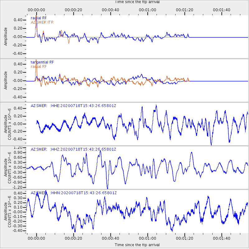
SMER AZ.SMER - Earthquake Result Viewer
*The percent match for this event was below the threshold and hence no stack was calculated.
| Earthquake location: |
Samoa Islands Region |
| Earthquake latitude/longitude: |
-15.3/-172.6 |
| Earthquake time(UTC): |
2020/07/18 (200) 15:32:35 GMT |
| Earthquake Depth: |
10 km |
| Earthquake Magnitude: |
6.2 Mww |
| Earthquake Catalog/Contributor: |
NEIC PDE/us |
|
| Network: |
AZ ANZA Regional Network |
| Station: |
SMER AZ.SMER |
| Lat/Lon: |
33.46 N/117.17 W |
| Elevation: |
355 m |
|
| Distance: |
71.7 deg |
| Az: |
46.499 deg |
| Baz: |
236.867 deg |
| Ray Param: |
$rayparam |
*The percent match for this event was below the threshold and hence was not used in the summary stack. |
|
| Radial Match: |
64.741745 % |
| Radial Bump: |
400 |
| Transverse Match: |
42.08095 % |
| Transverse Bump: |
400 |
| SOD ConfigId: |
21709731 |
| Insert Time: |
2020-08-01 15:36:44.811 +0000 |
| GWidth: |
2.5 |
| Max Bumps: |
400 |
| Tol: |
0.001 |
|
Signal To Noise
| Channel | StoN | STA | LTA |
| AZ:SMER: :HHZ:20200718T15:43:26.65801Z | 0.9876541 | 6.6127E-8 | 6.69536E-8 |
| AZ:SMER: :HHN:20200718T15:43:26.65801Z | 3.4238405 | 4.2803563E-7 | 1.2501623E-7 |
| AZ:SMER: :HHE:20200718T15:43:26.65801Z | 1.3801576 | 1.2674393E-7 | 9.1832945E-8 |
| Arrivals |
| Ps | |
| PpPs | |
| PsPs/PpSs | |


