You are here: Home > Network List > CI - Caltech Regional Seismic Network Stations List
> Station SMM Simmler, CA, USA > Earthquake Result Viewer
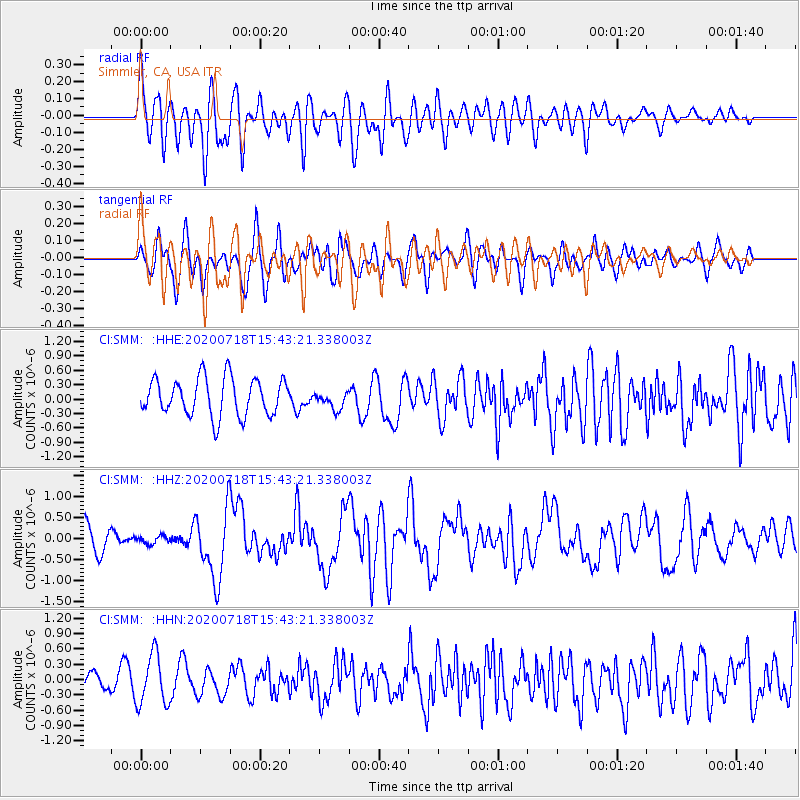
SMM Simmler, CA, USA - Earthquake Result Viewer
*The percent match for this event was below the threshold and hence no stack was calculated.
| Earthquake location: |
Samoa Islands Region |
| Earthquake latitude/longitude: |
-15.3/-172.6 |
| Earthquake time(UTC): |
2020/07/18 (200) 15:32:35 GMT |
| Earthquake Depth: |
10 km |
| Earthquake Magnitude: |
6.2 Mww |
| Earthquake Catalog/Contributor: |
NEIC PDE/us |
|
| Network: |
CI Caltech Regional Seismic Network |
| Station: |
SMM Simmler, CA, USA |
| Lat/Lon: |
35.31 N/120.00 W |
| Elevation: |
599 m |
|
| Distance: |
70.8 deg |
| Az: |
43.492 deg |
| Baz: |
234.313 deg |
| Ray Param: |
$rayparam |
*The percent match for this event was below the threshold and hence was not used in the summary stack. |
|
| Radial Match: |
70.196526 % |
| Radial Bump: |
400 |
| Transverse Match: |
61.46739 % |
| Transverse Bump: |
400 |
| SOD ConfigId: |
21709731 |
| Insert Time: |
2020-08-01 15:39:11.279 +0000 |
| GWidth: |
2.5 |
| Max Bumps: |
400 |
| Tol: |
0.001 |
|
Signal To Noise
| Channel | StoN | STA | LTA |
| CI:SMM: :HHZ:20200718T15:43:21.338003Z | 0.2695835 | 9.282936E-8 | 3.4434362E-7 |
| CI:SMM: :HHN:20200718T15:43:21.338003Z | 2.905192 | 4.9631234E-7 | 1.7083633E-7 |
| CI:SMM: :HHE:20200718T15:43:21.338003Z | 0.47423345 | 1.8563071E-7 | 3.9143316E-7 |
| Arrivals |
| Ps | |
| PpPs | |
| PsPs/PpSs | |


