You are here: Home > Network List > G - GEOSCOPE Stations List
> Station INU Inuyama, Japan > Earthquake Result Viewer
INU Inuyama, Japan - Earthquake Result Viewer
*The percent match for this event was below the threshold and hence no stack was calculated.
| Earthquake location: |
Samoa Islands Region |
| Earthquake latitude/longitude: |
-15.3/-172.6 |
| Earthquake time(UTC): |
2020/07/18 (200) 15:32:35 GMT |
| Earthquake Depth: |
10 km |
| Earthquake Magnitude: |
6.2 Mww |
| Earthquake Catalog/Contributor: |
NEIC PDE/us |
|
| Network: |
G GEOSCOPE |
| Station: |
INU Inuyama, Japan |
| Lat/Lon: |
35.35 N/137.03 E |
| Elevation: |
132 m |
|
| Distance: |
69.3 deg |
| Az: |
317.746 deg |
| Baz: |
127.45 deg |
| Ray Param: |
$rayparam |
*The percent match for this event was below the threshold and hence was not used in the summary stack. |
|
| Radial Match: |
75.587654 % |
| Radial Bump: |
400 |
| Transverse Match: |
65.339905 % |
| Transverse Bump: |
400 |
| SOD ConfigId: |
21709731 |
| Insert Time: |
2020-08-01 15:40:34.812 +0000 |
| GWidth: |
2.5 |
| Max Bumps: |
400 |
| Tol: |
0.001 |
|
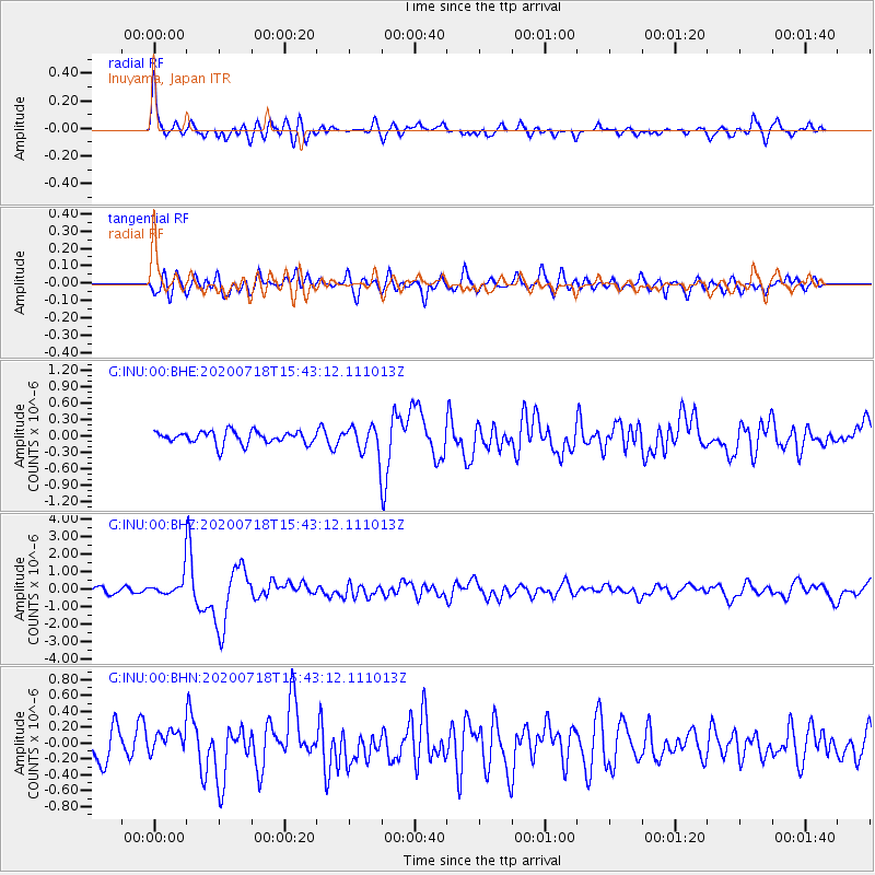
Signal To Noise
| Channel | StoN | STA | LTA |
| G:INU:00:BHZ:20200718T15:43:12.111013Z | 3.6063957 | 5.4967694E-7 | 1.5241724E-7 |
| G:INU:00:BHN:20200718T15:43:12.111013Z | 0.7859533 | 1.404143E-7 | 1.7865477E-7 |
| G:INU:00:BHE:20200718T15:43:12.111013Z | 2.1712787 | 2.5130595E-7 | 1.15741E-7 |
| Arrivals |
| Ps | |
| PpPs | |
| PsPs/PpSs | |


