You are here: Home > Network List > US - United States National Seismic Network Stations List
> Station WMOK Wichita Mountains, Oklahoma, USA > Earthquake Result Viewer
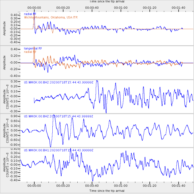
WMOK Wichita Mountains, Oklahoma, USA - Earthquake Result Viewer
*The percent match for this event was below the threshold and hence no stack was calculated.
| Earthquake location: |
Samoa Islands Region |
| Earthquake latitude/longitude: |
-15.3/-172.6 |
| Earthquake time(UTC): |
2020/07/18 (200) 15:32:35 GMT |
| Earthquake Depth: |
10 km |
| Earthquake Magnitude: |
6.2 Mww |
| Earthquake Catalog/Contributor: |
NEIC PDE/us |
|
| Network: |
US United States National Seismic Network |
| Station: |
WMOK Wichita Mountains, Oklahoma, USA |
| Lat/Lon: |
34.74 N/98.78 W |
| Elevation: |
486 m |
|
| Distance: |
85.9 deg |
| Az: |
52.486 deg |
| Baz: |
248.364 deg |
| Ray Param: |
$rayparam |
*The percent match for this event was below the threshold and hence was not used in the summary stack. |
|
| Radial Match: |
60.12026 % |
| Radial Bump: |
400 |
| Transverse Match: |
32.414436 % |
| Transverse Bump: |
400 |
| SOD ConfigId: |
21709731 |
| Insert Time: |
2020-08-01 15:49:25.906 +0000 |
| GWidth: |
2.5 |
| Max Bumps: |
400 |
| Tol: |
0.001 |
|
Signal To Noise
| Channel | StoN | STA | LTA |
| US:WMOK:00:BHZ:20200718T15:44:43.99999Z | 0.8080213 | 4.3799492E-8 | 5.4205863E-8 |
| US:WMOK:00:BH1:20200718T15:44:43.99999Z | 0.8489184 | 2.2276936E-7 | 2.624155E-7 |
| US:WMOK:00:BH2:20200718T15:44:43.99999Z | 0.8622265 | 3.3528295E-8 | 3.888572E-8 |
| Arrivals |
| Ps | |
| PpPs | |
| PsPs/PpSs | |


