You are here: Home > Network List > AV - Alaska Volcano Observatory Stations List
> Station SPCR Ckakachatna River, Mount Spurr, Alaska > Earthquake Result Viewer
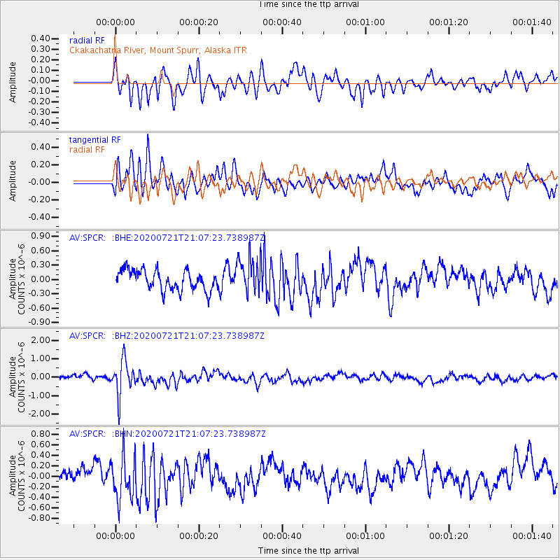
SPCR Ckakachatna River, Mount Spurr, Alaska - Earthquake Result Viewer
*The percent match for this event was below the threshold and hence no stack was calculated.
| Earthquake location: |
Fiji Islands Region |
| Earthquake latitude/longitude: |
-20.8/-178.6 |
| Earthquake time(UTC): |
2020/07/21 (203) 20:56:24 GMT |
| Earthquake Depth: |
602 km |
| Earthquake Magnitude: |
6.0 mww |
| Earthquake Catalog/Contributor: |
NEIC PDE/us |
|
| Network: |
AV Alaska Volcano Observatory |
| Station: |
SPCR Ckakachatna River, Mount Spurr, Alaska |
| Lat/Lon: |
61.20 N/152.21 W |
| Elevation: |
984 m |
|
| Distance: |
84.5 deg |
| Az: |
12.476 deg |
| Baz: |
204.666 deg |
| Ray Param: |
$rayparam |
*The percent match for this event was below the threshold and hence was not used in the summary stack. |
|
| Radial Match: |
68.886696 % |
| Radial Bump: |
400 |
| Transverse Match: |
67.89756 % |
| Transverse Bump: |
400 |
| SOD ConfigId: |
21709731 |
| Insert Time: |
2020-08-04 21:03:03.766 +0000 |
| GWidth: |
2.5 |
| Max Bumps: |
400 |
| Tol: |
0.001 |
|
Signal To Noise
| Channel | StoN | STA | LTA |
| AV:SPCR: :BHZ:20200721T21:07:23.738987Z | 6.261431 | 9.4606713E-7 | 1.5109438E-7 |
| AV:SPCR: :BHN:20200721T21:07:23.738987Z | 3.275807 | 4.104127E-7 | 1.25286E-7 |
| AV:SPCR: :BHE:20200721T21:07:23.738987Z | 1.852598 | 3.848037E-7 | 2.0771031E-7 |
| Arrivals |
| Ps | |
| PpPs | |
| PsPs/PpSs | |


